Stake Lake Cartwheel Trail

Table of contents
Route Description for Stake Lake Cartwheel Trail
While the Stake Lake Cartwheel Trail is a fairly straightforward and well-marked hiking route, there is a dense network of trails within McConnell Lake Provincial Park that intersect this route on a number of occasions, which can make navigation difficult. If you are planning on utilizing this trail, make sure to bring a trail map or GPS in order to maintain the correct route around the lake. Additionally, this trail can be a bit buggy due to its proximity to the water, so make sure to bring bug repellent to protect yourself while out on the trail.
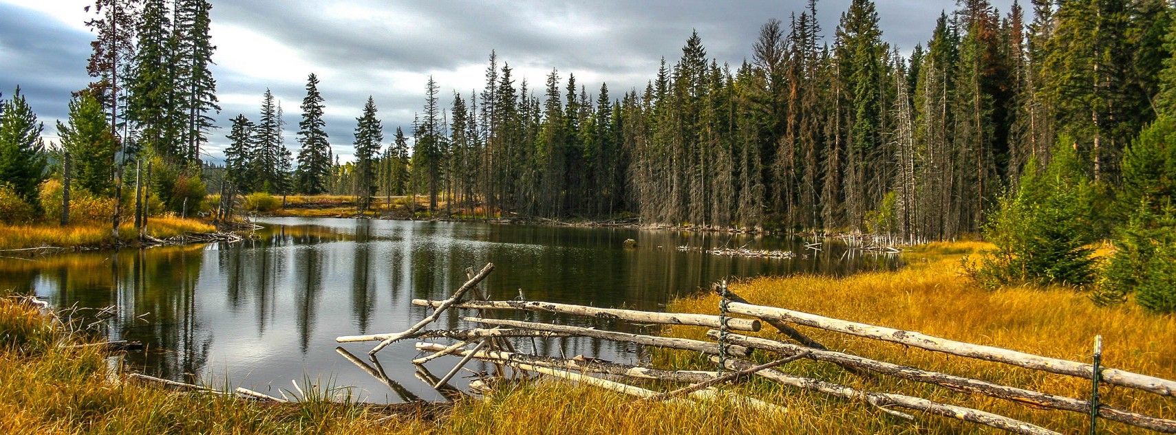
With its relatively flat trails, easy-to-navigate terrain, and beautiful woodland landscape, the Stake Lake Cartwheel Trail makes for a fun day of hiking that the entire family will be able to enjoy. The trail meanders around the charming shores of the lake, providing views across the water as you hike through scenic forests and beautiful meadows. This hike is a great option for simply catching up on some relaxation and reconnecting with nature.
Setting out from the trailhead between the ski lodge and park entrance booth, follow the trail to the southeast and pass through the initial junction. From here, you will enter into a beautiful stretch of forest that will provide some intermittent views of Stake Lake on your right, as you work your way along the easter half of the loop. After 600 m, you will come to a junction with some trails breaking off to your left. Ignore these and head straight to pass through a small but scenic meadow that will be filled with wildflowers in the late summer.
The southern edge of the lake will see the highest amount of intersecting trails that will threaten to pull you away from the main path, so make sure to keep an eye on the GPS and keep the lake on your right to follow it along its southern shore.
After exiting the cover of the forest, you will once again come to an open area of grassland that will lead you along the western edge of the lake and provide some nice views across its calm waters. Keep straight through the junctions along this part of the trail and you will soon cross over Cowan Creek and come to a small building at the edge of the trees on your left.
From this point, you will have a 650 m trek through another stretch of tranquil forest, before you arrive back at the trailhead where you began. If you are looking to spend some more time around Stake Lake, you can try exploring some of the other trails within the network, or get closer to the water’s edge to fully appreciate its beauty.
Insider Hints for Stake Lake Cartwheel Trail
- There are a lot of intersecting trails along this route, so make sure to bring a trap map or GPS to stay on the correct path.
- The trail can become muddy at times, so wear proper hiking footwear to keep your feet dry and comfortable.
- Due to the proximity of the trail to water, this trail can be a bit buggy. Bring bug repellent when out on this hike.
Getting to the Stake Lake Cartwheel Trail Trailhead
To access the trailhead for the Stake Lake Cartwheel Trail from Kamloops, make your way southwest along BC-1 for 2.1mi and turn off the highway using exit 366. After 984ft, turn left on Copperhead Drive and follow it for 623ft. Make a right turn onto Lac Le Jeune Road and follow it for 13.4mi. Turn left onto Stake Lake Ski Trail and follow it for 951ft to arrive at the trailhead.Route Information
When to do:
Year-Round
Backcountry Campsites:
No
Pets allowed:
Yes - On Leash
Family friendly:
Yes
Route Signage:
Average
Crowd Levels:
Moderate
Route Type:
Circuit
Stake Lake Cartwheel Trail Elevation Graph
Weather Forecast
Check Area WeatherReviews
WE ARE HERE TO HELP
Let someone else do the hard work, book a custom tour in over 85 countries.
Chat with us on our contact page or fill out the form below!