
BlogDestinationsTour du Mont Blanc Map: Route, Variations and Key Stops
Tour du Mont Blanc Map: Route, Variations and Key Stops

Lynn Campbell
Sep 28, 2026
Lynn is the co-Founder of 10Adventures. She had never slept outside until she was 28 years old, and now is an ardent hiker, backpacker, traveller, and bike tourer!
The Tour du Mont Blanc is a long-distance hiking circuit around the Mont Blanc massif, passing through France, Italy and Switzerland. The complete route covers roughly 170 km, linking high mountain passes, alpine valleys, villages and mountain refuges as it makes a full loop around the massif rather than climbing Mont Blanc itself.
This guide is designed to help you understand where the Tour du Mont Blanc goes. The overall Tour du Mont Blanc map shows the full circuit and its main stops, while the stage maps below provide a closer look at individual sections of the trail. For broader planning information beyond the route itself, see our Tour du Mont Blanc guide.
Overall Tour du Mont Blanc Map
Most hikers picture the TMB as a large loop around the Mont Blanc massif. On the traditional counterclockwise route, the trail leaves the Chamonix Valley from Les Houches, travels south through the French Alps to Les Contamines and Les Chapieux, then crosses the Col de la Seigne into Italy. From there, it passes through Val Veny to Courmayeur before continuing through Val Ferret and crossing the Grand Col Ferret into Switzerland. You cover a lot of ground (and countries)!
The Swiss section links La Fouly, Champex-Lac and Trient before the trail crosses back into France around the Col de Balme. It then follows the mountain slopes above the Chamonix Valley before returning toward Les Houches to complete the circuit. Along the way, Courmayeur is the largest town directly on the main circuit, while places such as Les Contamines, Les Chapieux, La Fouly, Champex-Lac and Trient are important reference points for understanding the route.
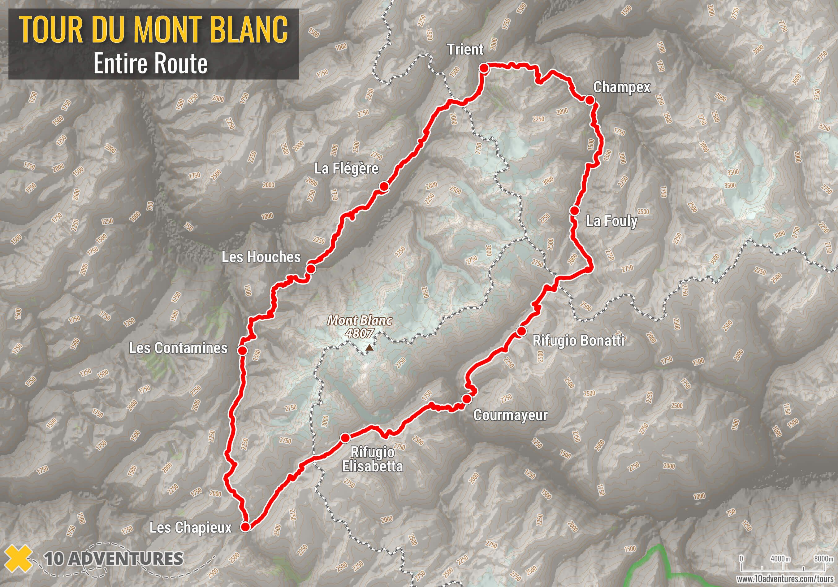
The full map is the easiest way to understand the geography of the trek. It shows how the route repeatedly crosses mountain passes and drops into valleys while circling Mont Blanc, as well as where the three international sections connect.
Tour du Mont Blanc Stage Maps
The Tour du Mont Blanc is commonly divided into around 10 or 11 walking stages, although the exact divisions vary between hikers and organized trips. The sections below use a common 11-stage counterclockwise structure so each map covers a clear part of the circuit. They are intended to explain the route geographically rather than prescribe a day-by-day itinerary.
Stage 1: Les Houches to Les Contamines
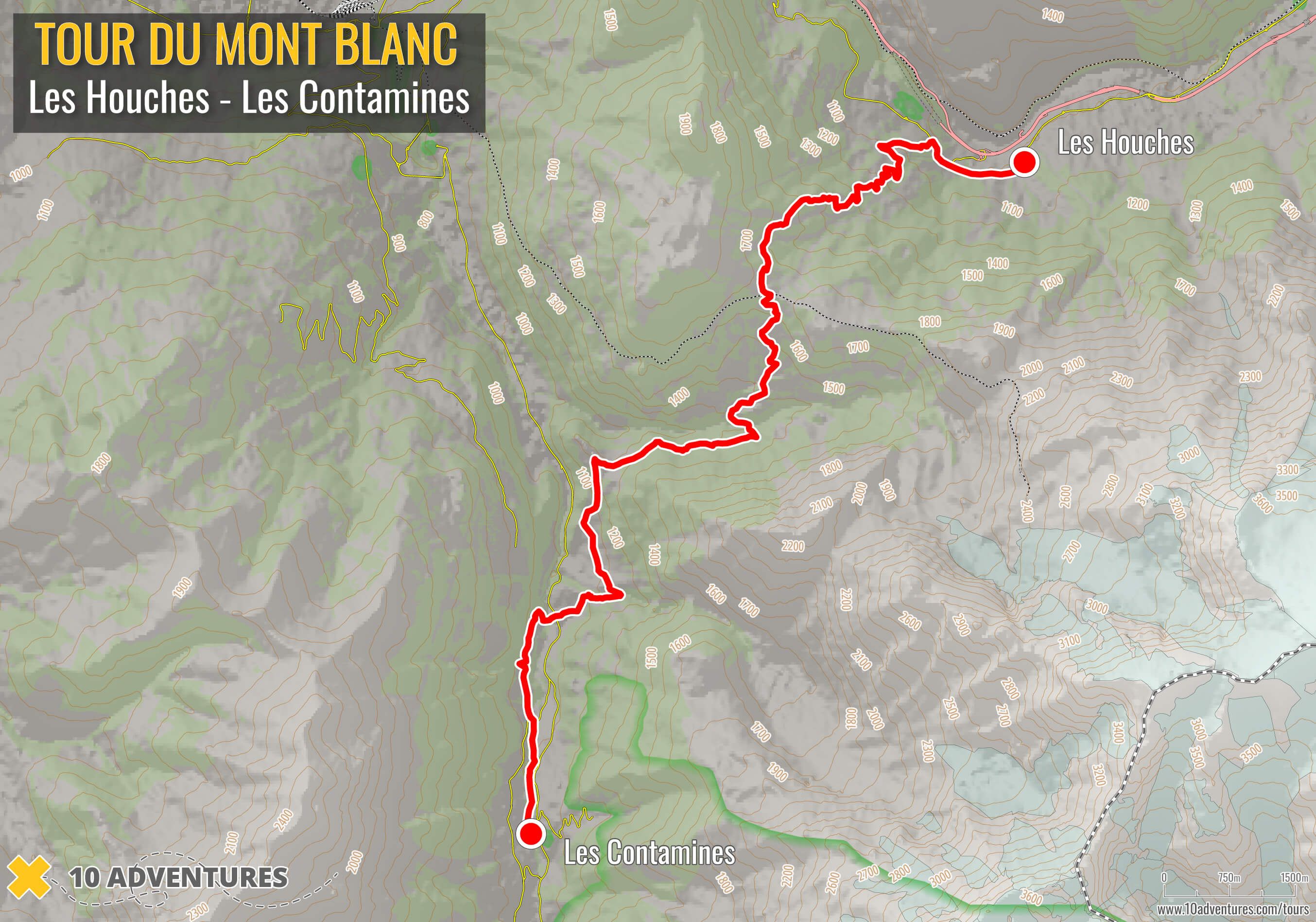
This section runs from Les Houches through the western side of the Mont Blanc massif toward Les Contamines, passing the Bionnassay area before reaching the Val Montjoie.
Stage 2: Les Contamines to Les Chapieux
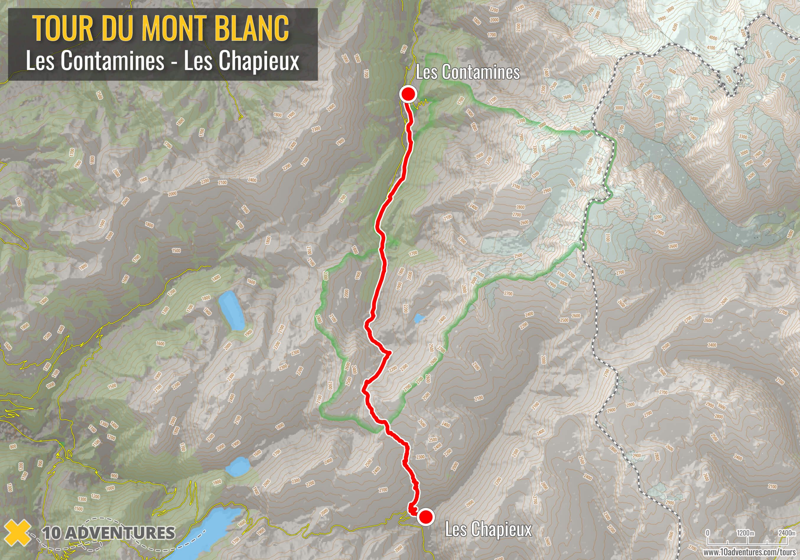
From Les Contamines, the route climbs toward the Col du Bonhomme and Col de la Croix du Bonhomme before descending to Les Chapieux.
Stage 3: Les Chapieux to Rifugio Elisabetta
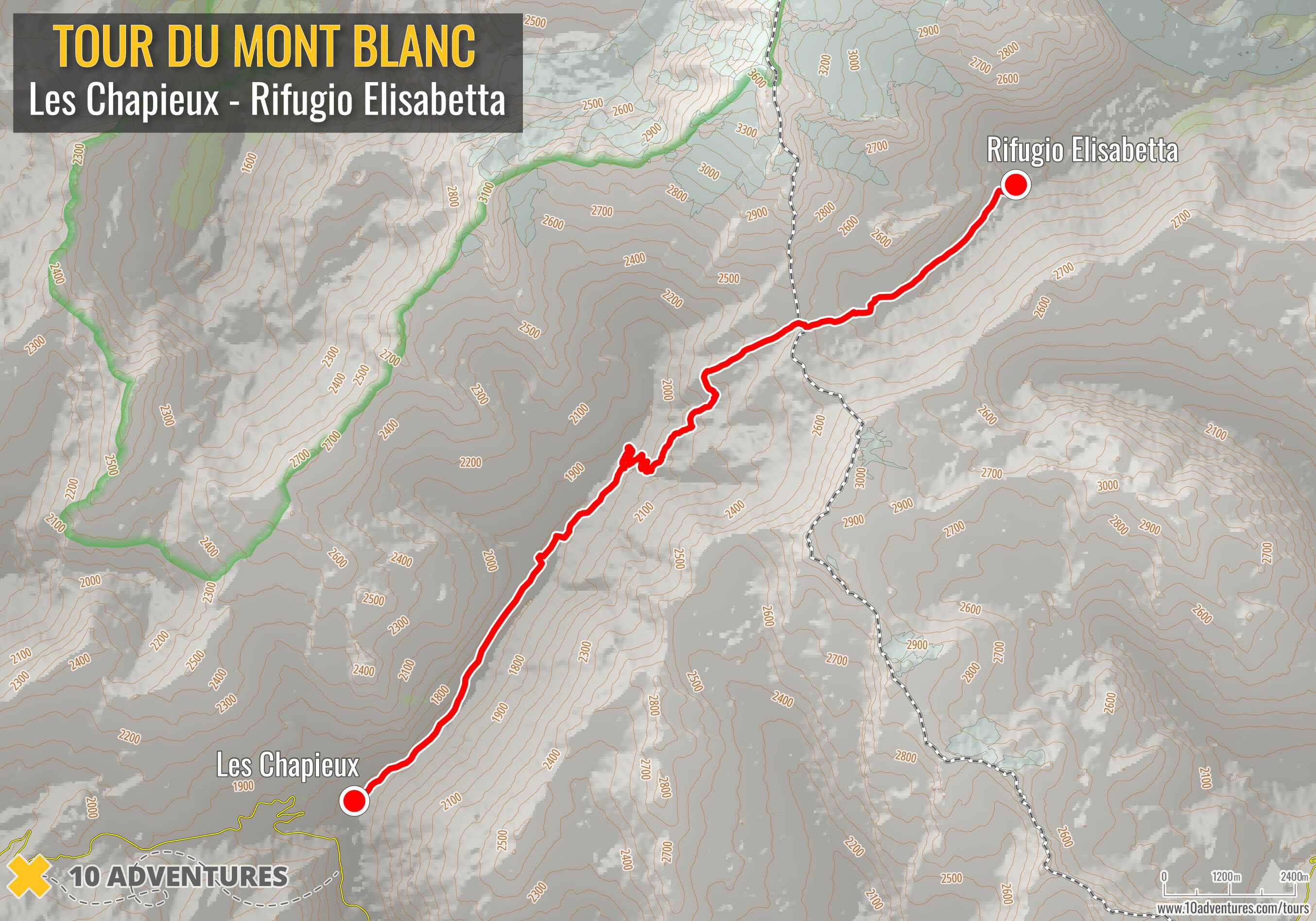
From Les Chapieux, the route follows the Vallée des Glaciers to the Col de la Seigne, crosses from France into Italy and continues through Val Veny to Rifugio Elisabetta.
Stage 4: Rifugio Elisabetta to Courmayeur
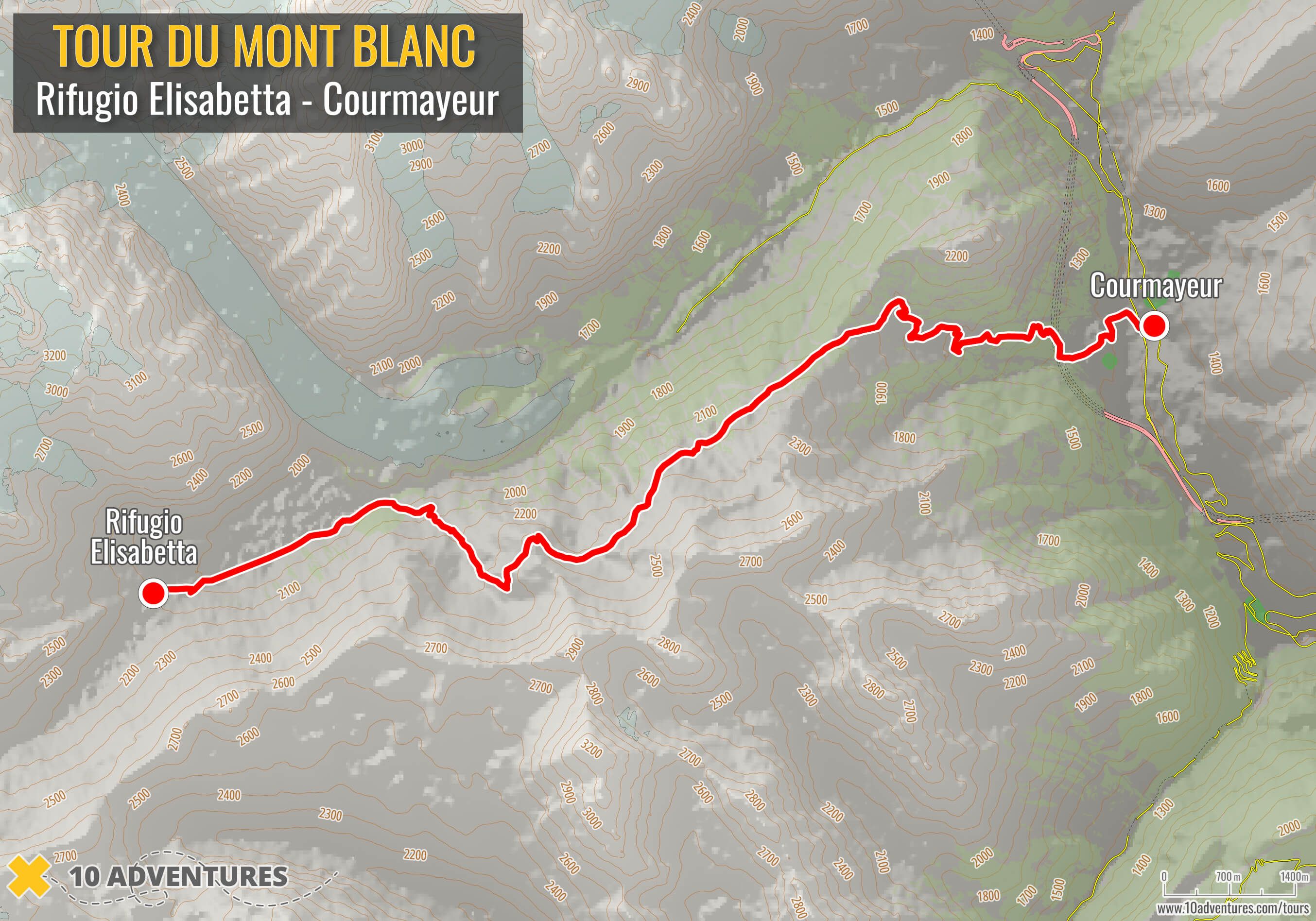
This section continues through Val Veny on the Italian side of the massif before descending into Courmayeur.
Stage 5: Courmayeur to Rifugio Bonatti
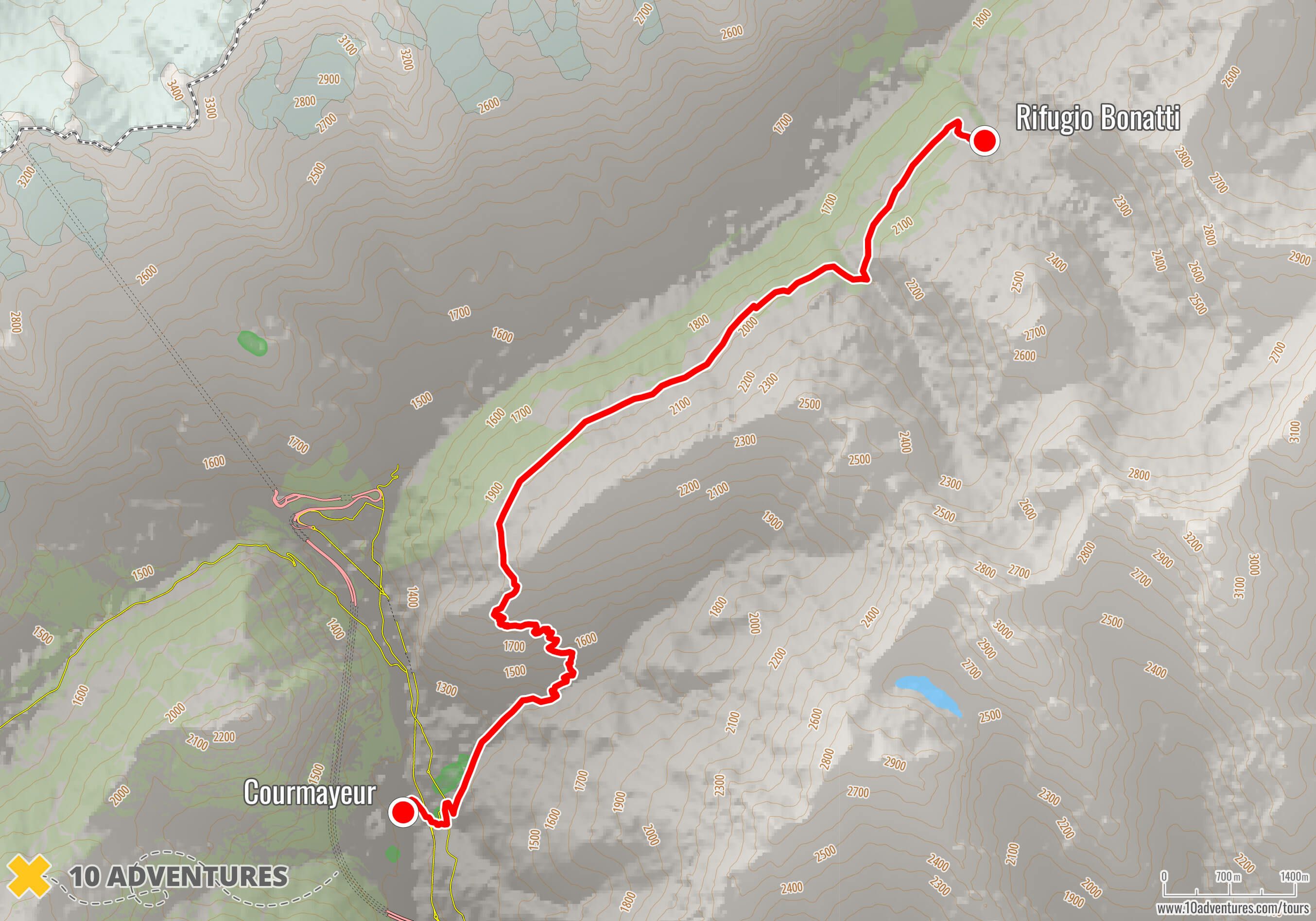
From Courmayeur, the route climbs above Val Ferret and follows the mountainside north toward Rifugio Bonatti.
Stage 6: Rifugio Bonatti to La Fouly
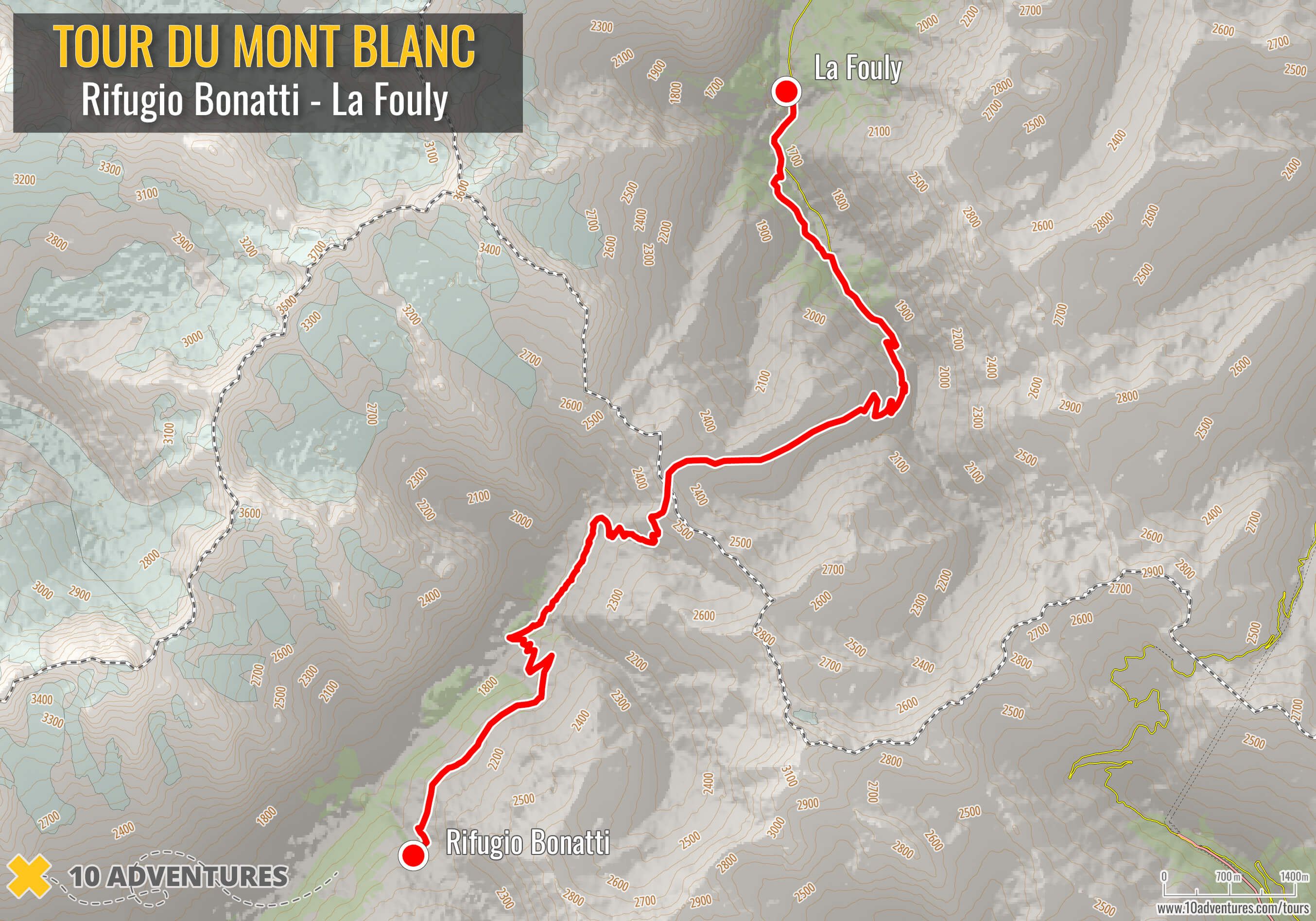
The route continues through Val Ferret, crosses the Grand Col Ferret from Italy into Switzerland and descends to La Fouly.
Stage 7: La Fouly to Champex
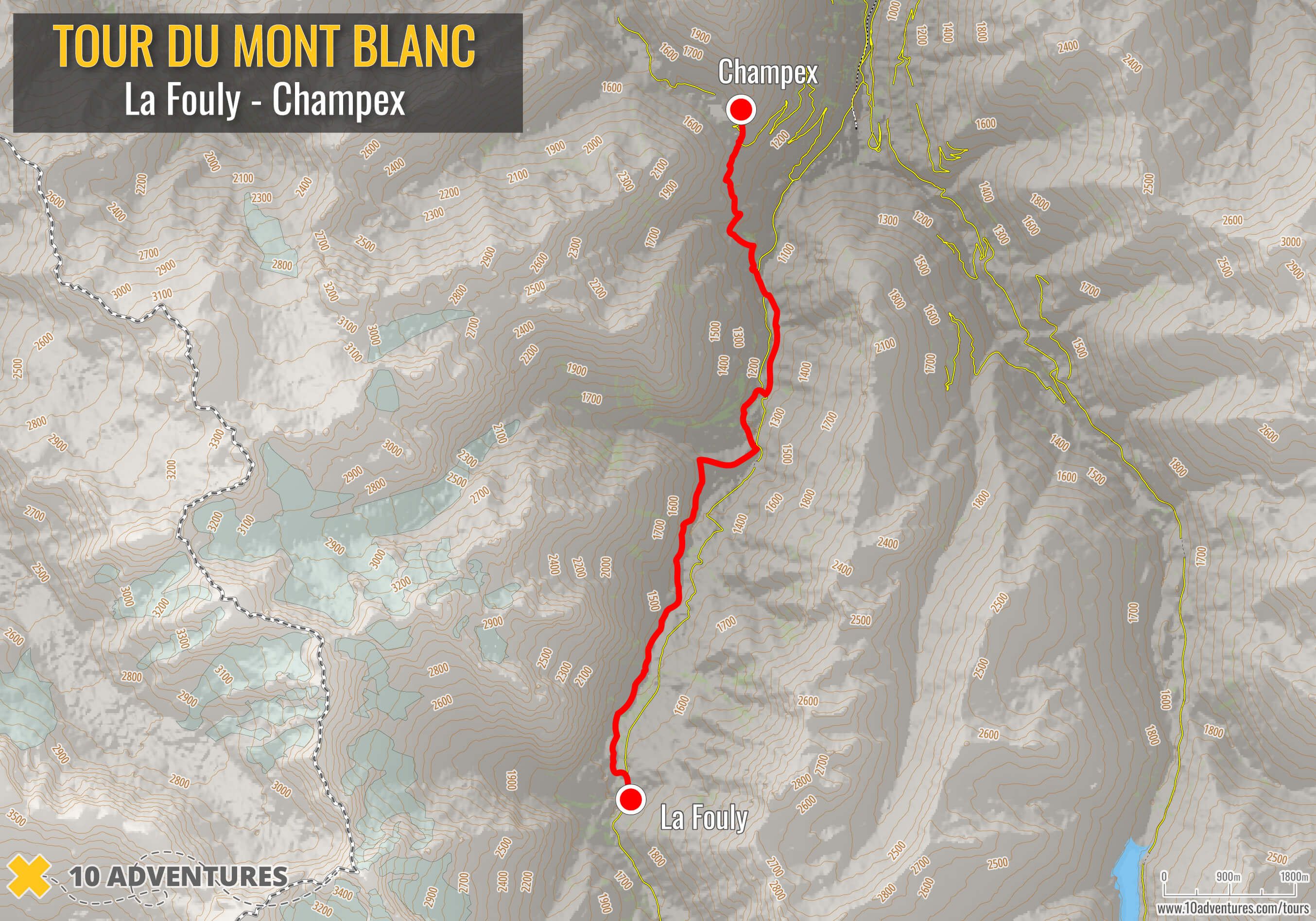
From La Fouly, the TMB follows the Swiss Val Ferret through the valley before turning toward Champex.
Stage 8: Champex to Trient
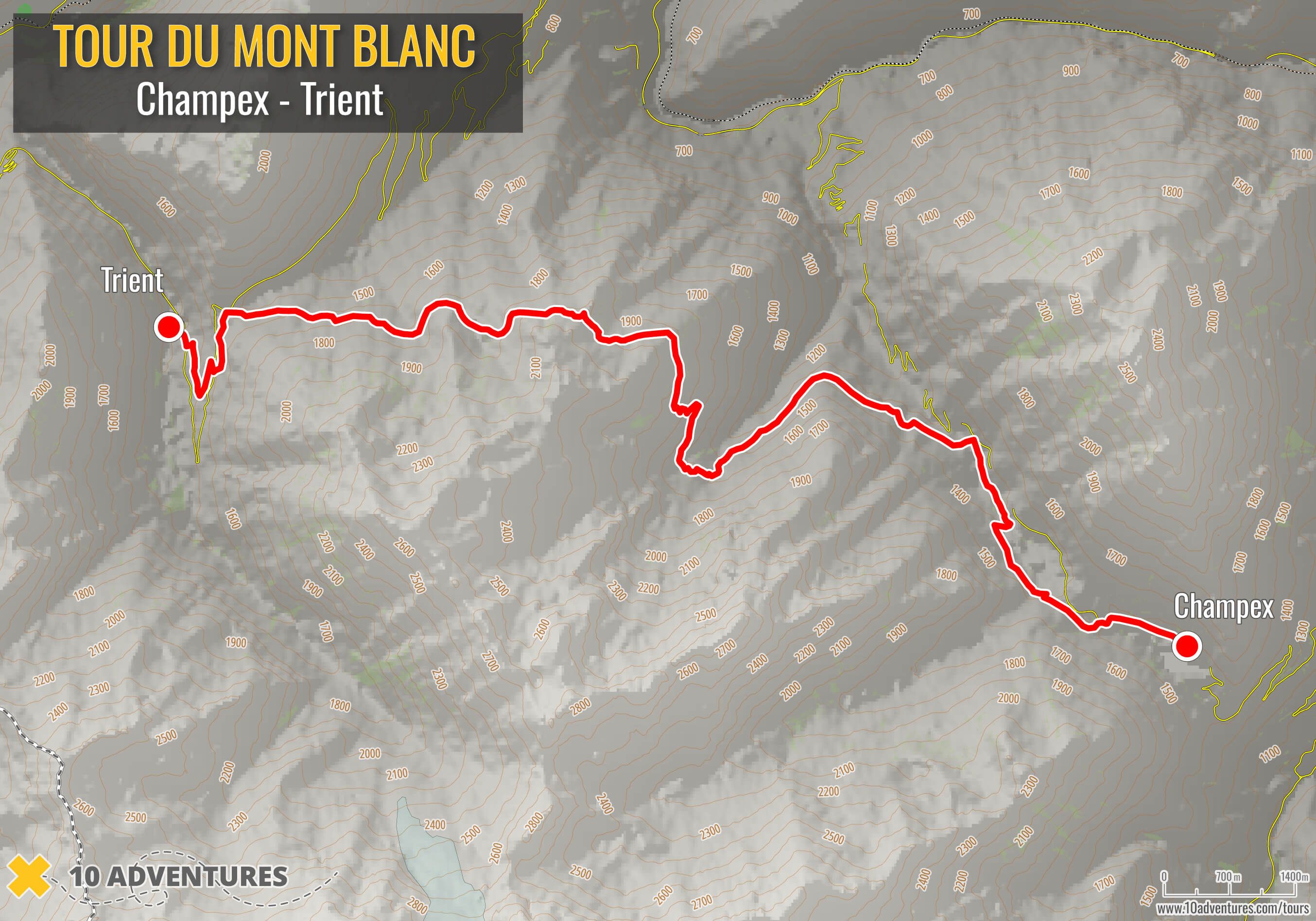
The standard route from Champex to Trient crosses the Bovine area and Col de la Forclaz before descending to Trient. The Fenêtre d'Arpette variant follows a higher alternative line through this section.
Stage 9: Trient to Montroc
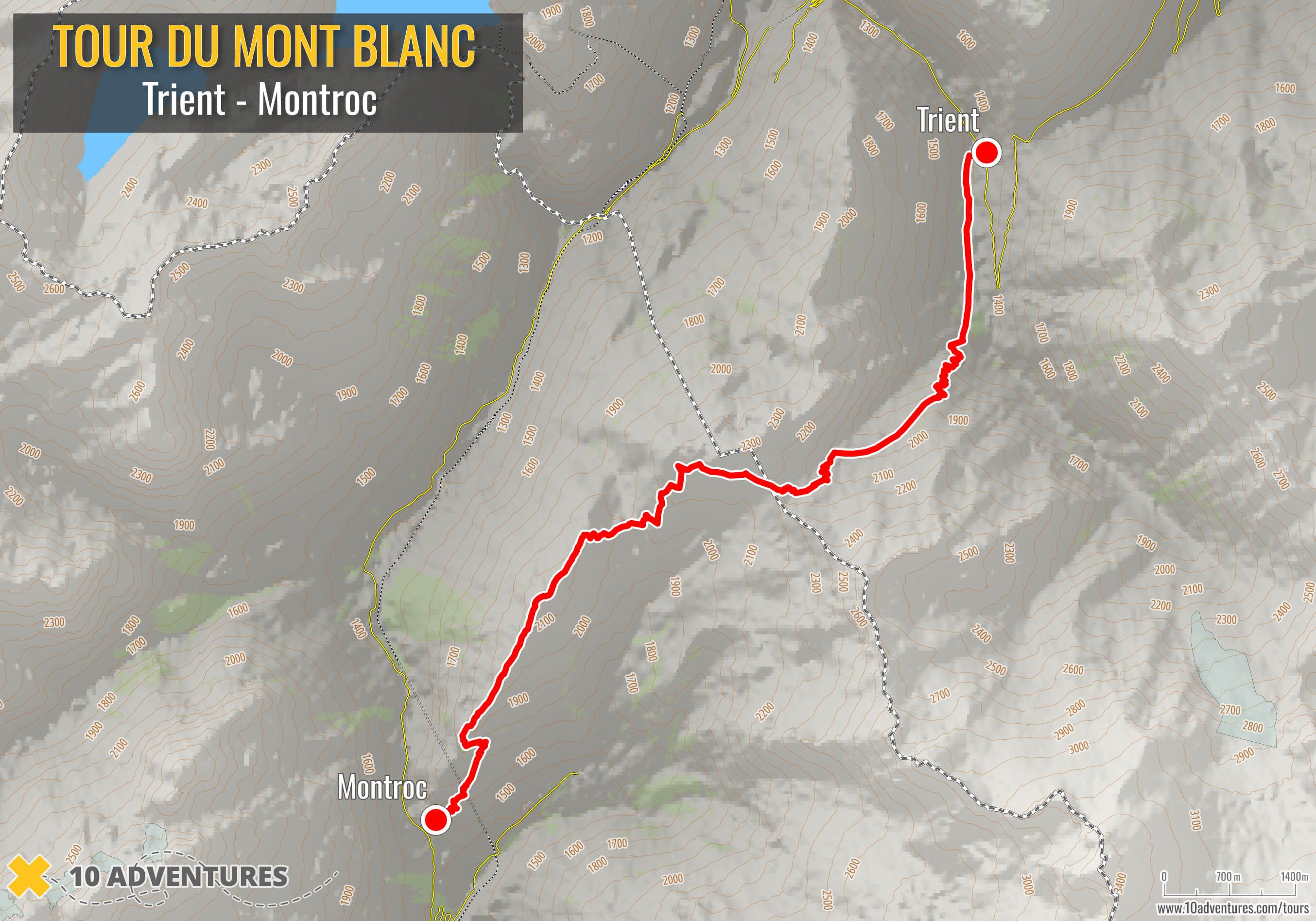
From Trient, the route climbs toward the Col de Balme, crosses from Switzerland back into France and descends through the upper Chamonix Valley to Montroc.
Stage 10: Montroc to La Flégère
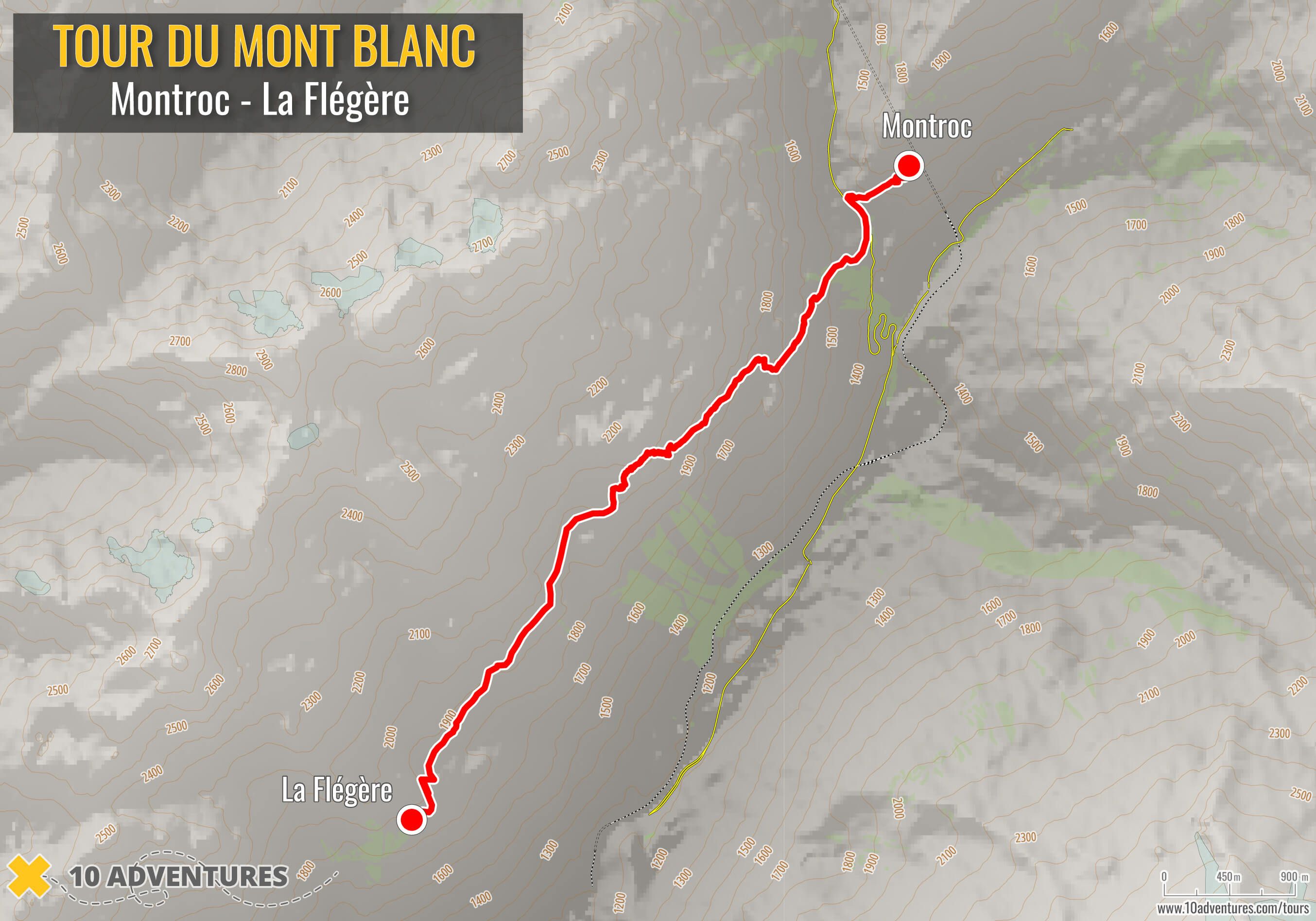
From Montroc, the route continues along the Aiguilles Rouges side of the Chamonix Valley, passing the Tré-le-Champ area before reaching La Flégère.
Stage 11: La Flégère to Les Houches
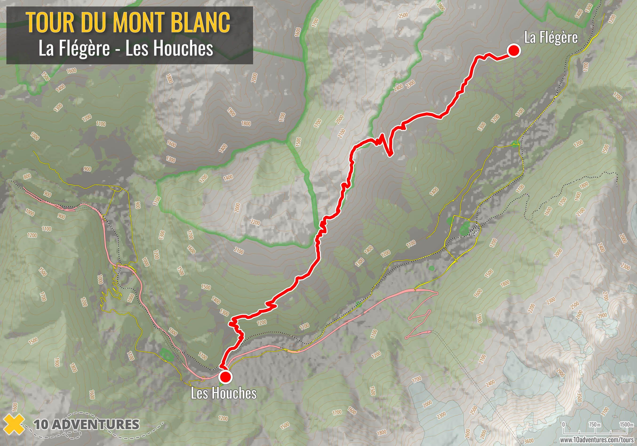
The final section continues from La Flégère toward the Brévent area before descending to Les Houches, completing the circuit around the Mont Blanc massif.
Main Tour du Mont Blanc Starting Points
Because the Tour du Mont Blanc is a circuit, there is no geographic requirement to begin at one fixed point. Les Houches is the traditional starting point for the full counterclockwise route and is the reference point used by many maps and guidebooks. Chamonix is also a major base for TMB hikers, with easy access to Les Houches and other parts of the Chamonix Valley.
Courmayeur is the main starting option on the Italian side and works particularly well for hikers joining the circuit from the Aosta Valley. The route can also be joined at other accessible places around the loop, including Les Contamines, La Fouly, Champex-Lac, Trient and Vallorcine.
The best starting point depends on transport, accommodation and the version of the trek you plan to walk.
Clockwise vs Counterclockwise
The TMB can be walked in either direction. Counterclockwise is the traditional and most commonly described direction, taking hikers from France into Italy, then Switzerland and finally back into France. Clockwise hikers follow the same circuit in reverse.
Which direction works best can depend on your trip style, accommodation availability and the route used by your chosen tour. The map is therefore useful for checking not only where you are going, but also the sequence in which you will reach each part of the TMB.
Tour du Mont Blanc Route Variations
The Tour du Mont Blanc is not a single unchangeable line. Several recognized variants branch away from the standard trail and later rejoin it. Some climb higher or cross more demanding terrain, so the route shown on one TMB map may differ slightly from another. Higher variants should be chosen according to experience, trail conditions and weather.
Col de Tricot: On the French section between Les Houches and Les Contamines, this alternative moves away from the lower standard route and crosses the Col de Tricot, passing close to the Bionnassay Glacier area before descending toward the Miage and Truc area. It adds a more mountainous character to the opening part of the TMB.
Col des Fours: After the Col de la Croix du Bonhomme, this higher alternative crosses the Col des Fours and descends toward the Vallée des Glaciers instead of following the standard route down through Les Chapieux. It eventually reconnects with the route toward the Col de la Seigne.
Fenêtre d'Arpette: Between Champex-Lac and Trient, the standard route passes through the Bovine and Col de la Forclaz area. The Fenêtre d'Arpette variant takes a much higher line through more demanding alpine terrain before descending toward the Trient side of the route. It should only be considered when trail and weather conditions are suitable.
These alternatives are useful to understand when reading a TMB map because two hikers can both complete the Tour du Mont Blanc while following different lines through certain sections. Variants should not be treated simply as shortcuts. A route that looks shorter on a map can involve more climbing, steeper terrain or more difficult trail conditions.
How to Use the TMB Map to Plan Your Trip
Start with the overall TMB map to understand the shape of the route. It shows the order of the three countries, where the major mountain passes sit, which towns and valleys connect the circuit, and where the trail returns to the Chamonix Valley.
The individual stage maps are more useful when you want to zoom in on a particular section. They can help you see where accommodation areas fall in relation to the trail, where a route variant leaves and rejoins the standard TMB, and how individual passes connect one valley with the next.
A map is only one part of planning the trek. If you are deciding how many days to allow, see our guide to how long the Tour du Mont Blanc takes. Our Tour du Mont Blanc accommodation guide covers refuges, hotels and camping along the circuit. To compare organized options, browse our Tour du Mont Blanc tours, including guided and self-guided trips.
Finally, use the maps as planning tools rather than as your only source of navigation in the mountains. Routes, trail conditions and access can change, particularly on higher variants, so check current local information before setting out.
Lynn Campbell
Sep 28, 2026
Lynn is the co-Founder of 10Adventures. She had never slept outside until she was 28 years old, and now is an ardent hiker, backpacker, traveller, and bike tourer!
Recent stories
Destinations
Trekking in Pakistan: Best Hikes and Walking Routes
Walking in northern Pakistan means high-altitude trekking through glacier valleys, alpine meadows, high passes, and remote settlements beneath some of the world’s highest mountains.
Richard Campbell
Sep 28, 2026
Destinations
Top Walking and Cycling Tours with Luggage Transfer
A point-to-point walking or cycling trip is easier to manage when you only carry what you need during the day.
Nadine Gravis
Sep 22, 2026
Destinations
Best Hiking and Cycling Tours for First-Time Active Travelers
Your first active vacation does not need to mean climbing a major peak or riding a mountain pass every day.
Lynn Campbell
Sep 19, 2026