
BlogDestinationsThe Ultimate Guide to New Zealand’s Te Araroa Trail
The Ultimate Guide to New Zealand’s Te Araroa Trail
Megan Honan
Nov 16, 2020
Megan is a Canadian writer and editor.
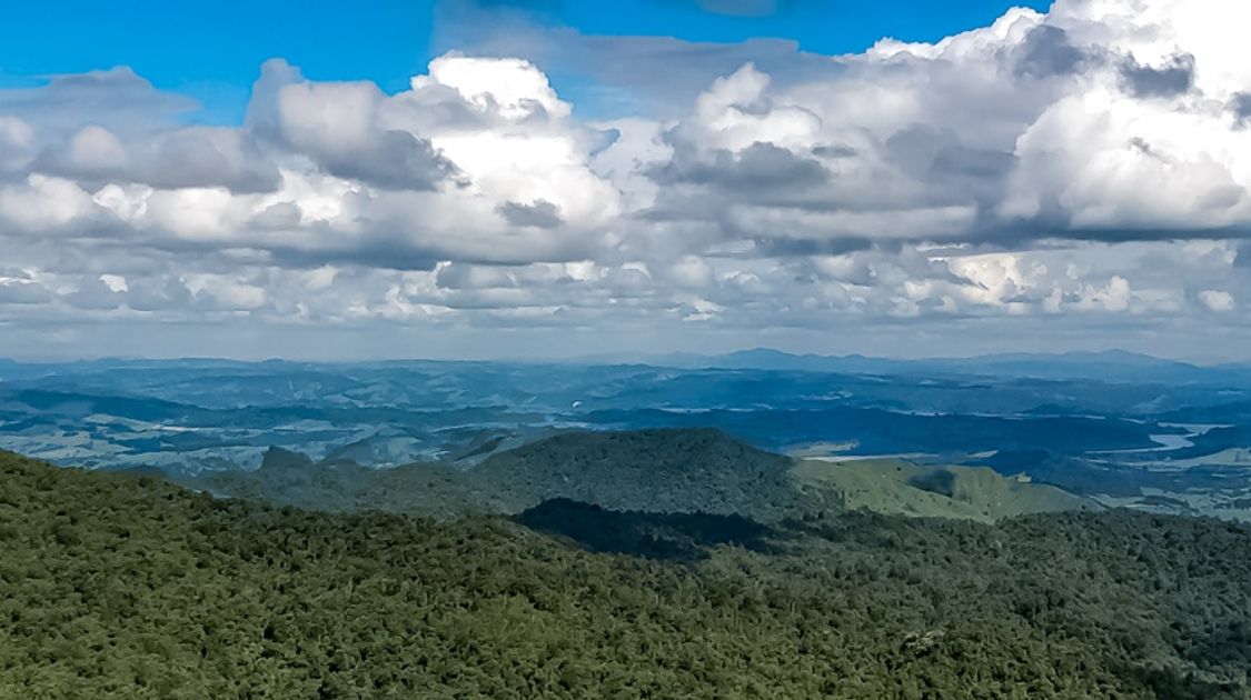
Discover remote villages, magical kauri forests, breathtaking volcanic scenery and bustling cities on New Zealand’s Te Araroa trail. This 3,000.0 km route stretches from Cape Reinga in the North Island to Bluff, located on the tip of the South Island. The Te Araroa is one of the world’s newest long-distance hiking trails, opening on December 3rd, 2011 and takes on average a whopping four to six months to walk in its entirety.
Te Araroa means “The Long Path” and it certainly lives up to its name. At an average of 25.0 km a day, the trail is not for the faint of heart. The North Island route is just over 1,600.0 km long, and the South Island just under 1,400.0 km. The Te Araroa trail is best tackled north to south, beginning from the top of the North Island at Cape Reinga in late spring. The traverse of the South Island then falls in mid- to late summer, when the mountain passes are clear of snow, and river levels are low.
While most hikers aren’t able to take enough time away from life to do the route in one stretch, it is possible to break up the hike and trek at your own pace if you are a local, or to do smaller stretches of the trail while on vacation. And if you’re lucky enough to trek the entire route in four months, you’ll certainly leave New Zealand with memories to last a lifetime!
Pack your bag and lace up those hiking boots for an epic adventure along New Zealand’s famed long-distance trail— The Te Araroa.

Beautiful sandy beach New Zealand along Te Araroa trail
The Basics Of Te Araroa Trail
The Te Araroa Trail is one of the newest long-distance trails in the world! Trekking this relatively unknown trail allows hikers to truly experience the beauty and wild remoteness of New Zealand. Chances are high that trekkers will hardly ever cross paths with other hikers along the trail, but there will be plenty of time spent in traditional Maori villages, where guests can learn about the local customs and ways.
The trail opened on December 3rd, 2011, running 3,000.0 km across the length of New Zealand’s two islands. The route was once just a dream, with no comparable long-distance trail available on the islands. Back in 1994, a local journalist, Geoff Chapple, began advocating for the creation of such a trail in his newspapers—which in turn led to the creation of the Te Araroa Trust.
Though the trail is currently in its infancy, there is no shortage of dreamers planning to attempt the rugged route. Last year alone, the Te Araroa received enough buzz to land on both National Geographic and CNN’s list of best long-distance hikes in the world. The route will take hikers anywhere between four to six months to complete, depending on how much time is spent on day excursions and rest days. On average, it is recommended the trail can be completed in 120 days—though feel free to trek at your own pace.
Te Araroa Walkway Information
The Te Araroa Trail requires considerable planning and forethought, which is why we at 10Adventures have created The Ultimate Guide, as well as a detailed GPS route and trail map—both of which can be downloaded and saved for offline use. It is paramount you have a GPS or mapping app on your phone to navigate the remote wilderness of New Zealand.
Te Araroa GPS Route
10Adventures offers a free Te Araroa route map available for download, so you can take your GPS coordinates offline!
Te Araroa Trail Map
We’ve also created a Te Araroa trail map, outing the entire 3,000.0 km trail, as well as recommend break point sections.
Te Araroa Trail Accommodation
Prepare for a lot of nights spent in tramping huts on the Te Araroa track. In the South Island, these tiny huts are likely going to be your accommodation for most of the trail and require a backcountry pass. This pass can be purchased in advance from the Department of Conservation for $92 for six months or $122 for twelve (as of Oct. 2020).
You can purchase single night tickets too, but this option is overall more expensive, unless you are only doing the North Island. In the South Island, you’ll likely stay in up to 28 huts, which averages out to less than $4/hut.
In the North Island there are only eight huts available, all of which are $5/night, except one is $10/night and the Mangatepopo Hut is $36/night. Note: the hut pass is not valid there. So if you are only doing the North Island then it is not worth getting a hut pass, but it definitely is for the South Island.
These backcountry huts are very basic, featuring bunk beds with plastic mattresses, though some have raised sleeping platforms that allow couples to sleep side-by-side. There are unfortunately no showers here and only drop toilets (bring your own toilet paper!), but you will find either a rainwater tank or a nearby stream for water. Most huts also have a fireplace, sometimes in the form of a wood burning stove, perfect for when you’ve arrived wet, tired and muddy.
Once in the North Island, you’ll have a chance to spend more time in either youth hostels or if you want to splurge, more luxurious hotels. You can grab a Youth Hostels membership, which will cost you $25 for the YHA membership, but you’ll receive a 10% discount off accommodation, requiring about 6 bookings to break even.
It should also be of note, that on occasion, you will find yourself in the wilderness with no huts or hostels nearby and you’ll have to camp for the night. We recommend carrying a light, cheap tent in the case you get stuck—but note it will be used infrequently. You also may need to use your tent if popular huts are full upon arrival. This can often happen at Greenstone Hut and Nelson Lakes.

New Zealand shoreline mountians sand landscape along Te Araroa trail
Te Araroa Itinerary
North Island
Te Araroa Stage 1: Cape Reinga to Ahipara
Kick off the Te Araroa trail from Cape Reinga, follow the path as it heads towards the West Coast, winding down steep cliffs and at times, over rocks until you reach the beautiful Te Werahi Beach, which you should cross at low tide for safety reasons. Trek over unusual peach-coloured dunes and take in sweeping views over Cape Maria Van Diemen and Motuopao Island. Follow the orange markers all the way to Twilight Beach, where you’ll find a 4WS track, follow it.
Continue as the track ascends to Scott Point and then steeply descends down to Ninety Mile Beach. Once you eventually reach Te Paki Stream, walk the sandy beach to Ahipara, leaving the water behind at Kaka Street boat ramp and heading into Ahipara village.
- Cape Reinga to Twilight Beach campsite (12.0 km / 1 day)
- Twilight Beach campsite to Maunganui Bluff campsite (28.0 km / 1 day)
- Maunganui Bluff campsite to Hukatere Lodge/Utea Park (30.0 km / 1 day)
- Hukatere/Utea Park to Waipapakauri Holiday Park (17.0 km) or Ahipara (a further 14.0 km /1-day)
Te Araroa Stage 2: The Northland Forests
Note that the previous trail section through Herekino Forest is now closed, so instead, hikers should start this section from the boat ramp on Ninety Mile Beach, following Ahipara Road to Kaitāia. This can be an incredibly busy road, so proceed with caution. Once in Kaitāia, you’ll need to get a ride to Ruaroa Road, as the highway is too dangerous to trek. Continue until you reach Takahue Road and into Takahue to rejoin the Te Araroa Trail. Continue until you reach the junction with Warner Rd.
- Raetea Forest Track (18.0 km / 9.5hr)
- Omahuta Puketī Forest Track (30.0 km / 2 days)
- Omahuta Puketī Forest Track 31.0 km / 2 days)
Te Araroa Stage 3: Kerikeri Walkway
Set out from the Puketī Recreation Centre, crossing into farmland territory. Once at Mangakaretu Road, follow the gravel road until you reach the next farm stile. Follow uphill, crossing over a fence into a scrub, before arriving next to the Maungaparerua Stream. Continue until the junction at Kerikeri River, which you’ll follow to a picnic area adjacent to SH10.
Push onwards, following the orange markers across private land, until joining with the Department of Conservation's Kerikeri Walkway near Rainbow Falls Rd. Stop here to observe the stunning falls, which were carved by the volcanic eruptions that once took place here. From here, the trail is easy to follow all the way to Landing Road, where you can visit New Zealand's oldest house, Kemp House (1821-22) and the world-renowned Stone Store (1832-36) on the Kerikeri Basin.
- Mangakaretu Track (20.0 km / 6 hours)
- Kerikeri River Track (6.5 km / 2 hours)
Te Araroa Stage 4: Kerikeri to Waitangi
Depart from Kerikeri Road, now following the Kororipo Pā Track, which snakes and follows the headland, before turning to the southeast. Trek across the wide pasture tracks and once you reach a Department of Conservation marker post, follow it southeast towards Pā Road and onto Kerikeri Inlet Road. Continue until you reach the start of the Waitangi Forest Track, following it all the way to Waiting Bridge.
- Waitangi Forest Track (14.5 km / 3 hours)
Te Araroa Stage 5: Paihia to Opua Coastal Walkway
This section provides two options from Paihia Beach:
- When the tide is out, follow the coastline from Paihia Beach around to Haumi Bay.
- If the tide is in, take the footpath south on Seaview Road to Haumi Bay.
Te Araroa Stage 6: Opua Coastal Walkway to Waikara Landing
The easiest way to conquer this section is by road. From Opua, take the vehicle ferry over the Veronica Channel to Okiato. Upon arrival, follow Aucks Road for around 4.5 km, turning right onto Russell-Whakapara Road. Continue to follow the road for 10.0 km, turning right onto Waikara Rd and into Waikara Landing. There is an option here to also kayak with Bay Beach Hire.
Te Araroa Stage 33: Russell Forest to Whangarei Heads
This track is often a highlight with stunning viewpoints over the native bush and the coast off in the distance. Start in Waikare Landing, walking on Waikare Valley Road, crossing over Waikare River. Eventually, you’ll walk up Papakauri Stream, which may take some time. Once on Webb Road, you’ll start the Helena Ridge Track, then onto Morepork-Onekainga Track and finally, Whananaki Coastal Track.
- Helena Ridge Track (9.0 km / 4 hours)
- Morepork-Onekainga Track (13.0 km / 4-5 hours)
- Whananaki Coastal Track (7.0 km / 2.5 hours)
Te Araroa Stage 7: Ngunguru
Begin from Waiotoi Road, heading right onto Ngunguru Road, through the village. This is a great spot to refill on supplies. Head to the Ngunguru River Boat Crossing, where you’ll ride across to Nikau Bay Camp and Cabins, where you can stay the night. Once you are ready to depart, head towards a T-junction, where you have two options to cross the Horahora River.
- Head right and follow the 19.0 km free trail route
- Head left and follow a 3.5 km trail through private Māori land, costing $5/person.
We recommend the second option to save on time.
- Mackerel Forest Track (4.0 km / 1.5 hours)
- Taiharuru Estuary Route (7.0 km / 2 hours)
- Kauri Mountain Track (3.0 km / 1.5 hours)
- Ocean Beach Walk (9.0 km / 3 hours)
- Bream Head (Te Whara) Track (7.0 km / 5-6 hours)
- Reotahi Track (3.0 km / 1 hour)
Te Araroa Stage 8: Bream Bay Walk
Depart from Marsden Point, heading south along the beach until you reach Tip Road west. Head south onto Uretiti Road, and south again onto Nova Scotia Drive to head into the heart of Waipū.
- Bream Bay Walk (16.0 km / 4 hours)

Stunning sunrise over tents campsite along Te Araroa trail New Zealand
Te Araroa Stage 9: Cullen Brynderwyn Walkway
From Cove Road, head uphill on Cullen Road onto a 4WD track and eventually onto DOC’s Brynderwyn Walkway (a graded farm track).
Te Araroa Stage 10: Bream Tail Mangawhai Walkway
Head out from the carpark, following the no-exit Bream Tail Road. It may look like a private driveway, but not to worry, you are in the right spot. Ascend a hill to lookout over the coast, then follow the orange markers past rolling pastures, up the zig-zag path to the beach. Eventually you’ll reach the carpark at Mangawhai Heads.
Te Araroa Stage 11: Mangawhai to Pakiri
From the carpark, head to the walkway by 44 Wintle Street. Once you reach Mangawhai Village, turn right onto Moir Street, finding your way to Black Swamp Road. Continue onto Pacific Road, where you’ll find a forest path leading to the beach and the next section of the Te Araroa trail. Trek along the beach, crossing the Pākiri River and then turn inland to reach Pākiri River Road.
Te Araroa Stage 12: Mt Tamahunga (Te Hikoi o te Kiri) Track
From Pākiri River Road, cross over and continue onto Bathgate Road. Follow the orange markers through a sheep pasture, then down onto a muddy saddle, so take care! Trek through a stunning pine plantation on the way to the summit for amazing views. From here, the trail descends steeply and with rough terrain, so take your time. You’ll eventually reach a weather satellite station, before finally arriving at a grassy hill and a more developed, but narrow path. Follow this all the way to Matakana Valley Road.
Te Araroa Stage 13: Govan Wilson to Puhoi Valley
Start by following a clay 4WD track, passing by an abandoned old bus on the way to Conical Peak Road. Take the right fork, then left turnoff to arrive on the DOC’s Tōtara Scenic Reserve. Hike through mostly bush track into the Waiwhiu Valley, climbing to the Dome trig. There will be some steep scrambles and some experience is required to access the lookout platform on the trail for views over the Hauraki Gulf. Continue until you reach the Dome Cafe carpark. Immediately across the road is Kraack Road, which you’ll follow up to a forestry gate, passing it onto a new narrow path. You’ll find the route reconnecting at the entrance to #121, follow the markers until you reach the Waihunga Track. From the Ahuroa - J Tolhopf Road intersection, follow the bush line, passing famed “Sugarloaf” rock formation. Push onwards southeast to the swing bridge on Ahuroa Road where you’ll find the next track.
- Govan Wilson to Dome (15.0 km / 6-7 hours)
- Dome to Moirs Hill (16.0 km / 4-5 hours)
- Dunns Ridge Track (2.5 km / 1 hour)
Te Araroa Stage 14: Puhoi Track
Cross the Puhoi River by swing bridge to kick off this section. You’ll pass plenty of young kauri trees on this route as you climb to the highest point on the track. It’s a steep climb, but the views are some of the best on the trail. Continue onto Puhoi Lookout Loop with two options, one direct but steep and slippery, the other longer, but with gentler grade. Both eventually exit into the Puhoi Domain, where the Puhoi pub is waiting with a pint.
Te Araroa Stage 15: Puhoi to Wenderholm by kayak
This next section needs to be completed by kayak and requires rentals to be pre-booked. Contact the below in advance:
- Puhoi River Canoe & Kayak Hire - 84 Puhoi Rd, Puhoi (Opposite the Historic Puhoi Church) - P: 09 422 0891 or 027 2841672
Te Araroa Stage 16: Wenderholm to Stillwater
Note: This next section requires an out-going tide, so please check ahead of time.
Walk the stunning grounds of the old Couldrey House, where the Perimeter Track starts, following it to reach the beach. From here, it's an easy stroll during low tide to Hatfields Beach, where at the end you’ll find the walkway steps up to Ocean View road. Just over the Hibiscus Coast Highway, you’ll find Lookout Point, which is a can’t miss spot. From there, continue onto the Te Ara Tahuna, following it all the way to the Stillwater Boating Club.
- Wenderholm to Orewa Estuary (11.5 km / 3 hours)
- Orewa Estuary to Stillwater (13.0 km / 3 hours)
Te Araroa Stage 17: Okura to Long Bay
You have two options for today’s hike:
Low tide: Take the DOC’s Okura Bush Walkway, where you can wade across the Okura Estuary at low tide, then once across, follow the cliffs to Long Bay Regional Reserve
High tide: Also hop on the Okura Bush Track, until you reach a spit with a shallower crossing to the ramp at the end of Okura River Road. From here, get onto Glenvar Road and follow it all the way to Long Bay Regional Park.

Sunrise sunset at the beach ocean along Te Araroa trail New Zealand
Te Araroa Stage 18: Long Bay to Onehunga
This section requires multiple bay crossings and careful consideration needs to be given to low tide times. We recommend breaking the walk partway, and completing it at low tide the following day. Since it can vary so much, it’s hard to estimate the time required to complete this section, but we suggest two full days.
- Long Bay to Torbay
- Torbay to Browns Bay
- Browns Bay to Rothesay Bay
- Rothesay Bay to Murrays Bay
- Murrays Bay to Mairangi Bay
- Mairangi Bay to Campbells Bay
- Campbells Bay to Castor Bay
- Castor Bay to Milford
- Milford to Takapuna
Te Araroa Stage 19: Onehunga to Puhinui
From Onehunga Bay Reserve, depart heading southeast onto Orpheus Drive. Trek past the end of Māngere Bridge, and while the bridge is closed to foot traffic, you’ll find the trail crosses the harbour on a pedestrian underpass. Once across, follow the coast to Ambury Regional Park, where just past the kissing gates, you’ll spot signage for the Māngere Foreshore Track, which you’ll follow until you reach the Puhinui Reserve.
- Māngere Foreshore Track (9.0 km / 2.5 hours)
Te Araroa Stage 20: Puhinui Stream Track
Cross over a stile to start today’s trek. From here hop on the gravel path and follow as it weaves along the Puhinui Stream. Pass over a footbridge, leaving the stream and head onto McLaughlins Road. Continue to Wiri Station Road, and at the intersection for Lambie Drive and Druces Road, find the Puhinui Stream track open again at a diagonal path. Follow the path through the stunning Auckland Botanic Gardens to end this track.
Te Araroa Stage 21: Totara Park to Mangatawhiri River
Heading away from the gardens, you’ll arrive at Wairere Road—follow it all the way to the end. Head to Stratford Road, for a large roundabout intersection, where you’ll turn right into Ranfurly Road. Find your way to Great South Road, which you’ll follow for 3.7 km to the roundabout in Drury, turning left onto Waihoehoe Road and over the Main trunk Railway. This ends the footpaths section and the rest of the trail follows urban streets. Make your way to Pinnacle Hill Road for 6.5 km until you reach State Highway 2., where you’ll take a bridge over the Mangatāwhiri River. Cross the road on to the stopbank on the southeast side of the river.
Te Araroa Stage 22: Hunua Ranges
Follow the stile over the fence to start the Wairoa River Track. Keep to the right of the river for about 2km, before the trail skirts around a gorge and climbs uphill. Once you reach an intersection, follow the track downwards across a small stream and into a pine plantation. Watch for the markers as you follow them all the way to Cossey Access Road. From here, you’ll begin the Cossey Gorge Track, where you’ll walk down steps to join the Massey Track. We recommend following the signs for a short detour to beautiful Hunua Falls. Afterwards, follow Massey Track to Wairoa-Cosseys Track, and onto the road at Repeater Road. Push onwards to the Lower Mangatāwhiri Track, crossing over the river and out to Lyons Road.
- Wairoa River Track (4.0 km / 1.5-2 hours)
- Hunua Ranges Track (30.0 km / 1.5 days)
Te Araroa Stage 23: Mangatawhiri to Mercer
This section is fairly remote as it winds through little-known villages, featuring Dutch Polder-style agriculture. Follow the stopbank on the left side of the Mangatāwhiri River. Once you reach a drainage ditch, follow the trail as it takes a sharp right and ending at McIntyre Road. Follow this road over the railway line and turn left to find the marked route across from the motorway, continuing until you reach the Mercer Service Centre.
- Mangatawhiri River Track (6.5 km / 2 hours)
- Mercer (4.5 km / 1.5 hours)
Te Araroa Stage 24: Mercer to Rangiriri
Prepare for an incredibly scenic, but hilly portion of the trail. Follow the orange markers over farmland and ascend with beautiful sights over Waikato River and the surrounding wetlands. Once on the Whangamarino Wetlands Track, follow the Waikato River to the outfall by the former power station, then head to the highway shoulder until you arrive at Dragway Road. From here, spot the rock markers that signal the start of Waikato River trek. The trail ends at an old redoubt, where the nearby Rangiriri Battle Site Heritage Centre displays interesting militia artifacts. Follow the riverbank under a bridge, the scramble the ridge to cross Rangiriri Bridge on the south side for the next leg.
- Whangamarino Redoubt Track (2.5 km / 45 minutes)
- Whangamarino Wetlands Track (5.5 km / 2 hours)
- Waikato River (17.5 km / 6 hours)
Te Araroa Stage 25: Rangiriri to Huntly
This riverside track runs parallel to Te Ōhākī Road, making it easy to follow. You’ll pass through Huntly Golf Course. For the last section of the road, you’ll pass through pretty Sculpture Park, then head south until you eventually turn right onto Parker Road, reaching the Department of Conservation's Hakarimata Scenic Reserve.

Beautiful New Zealand jungle forest hiking Te Araroa trail
Te Araroa Stage 26: Hakarimata Walkway
This track is known for its steep and hilly route that provides unparalleled views over Hamilton. There are car parks at both ends of the track and it is easy to follow the trail markers here.
Te Araroa Stage 27: Ngāruawāhia to Hamilton - Te Awa (The River)
This section starts with a sharp left onto Sampson Street and eventually onto Lower Waikato Esplanade. Follow the trail under a railway track and onto the Te Awa cycle/walkway. Follow the river, past a golf course and a beautiful green bridge will be directly in front of you. Cross over and onto the Te Awa path closer to the river, just past the Fonterra dairy plant.
Te Araroa Stage 28: Hamilton City
Continue on the Te Awa path, through Brathwaite Park and travel through the urban city, where there is ample spots for shopping. Head back onto farmland on a paved walkway from Tills Lookout and trek to the Taitua Arboretum.
Te Araroa Stage 29: Waipā Walk
Cross over multiple stiles and walk into Whatawhata Village when there is a tavern and refreshments. From here, walk on the left bank of the Waipā River, following orange markers to Old Mountain Road and the start of the Kapamahunga Walkway. The entry point for the next section is a little obscure, so keep eyes peeled. Pass a rural airstrip and you’ll reach the intersection of Fillery Road and Limeworks Loop road. Follow the signs to the carpark.
- Kapamahunga Walkway - 10.5 km / 3-4 hours
Te Araroa Stage 30: Pirongia Traverse
Hop on the Tahunanui Track, leading past a campsite and then upwards to the summit ridge of Pirongia. This takes roughly 4-5 hours and about 30 minutes past the summit is the Pahautea Hut, which is a good place to spend the night. The next day, set out on the new Noel Sandford boardwalk, which follows the Hihikiwi Track, taking you to the next Te Akeohikopiro Peak, before heading downwards to Pirongia West Road.
Te Araroa Stage 31: Pirongia to Waitomo
Make sure you come prepared for some true backcountry road walking for this section. Heading out from the Omanawa Stream, follow Pirongia West Road. The trail treads through farmland, turning into bush and eventually, an old timber trail. Follow the track all the way into Waitomo Village.
Te Araroa Stage 32: Pehitawa Track
Set out on a slightly challenging medium-grade trek, passing through scenic farms and bush for much of the trail. At times, the road surprised with steep inclines and descents. It levels at the tip top of high karsts, providing a lookout over King Country with views of far off volcano summits– north to Pirongia, east to Pureora, and south to Ruapehu.
Te Araroa Stage 33: Te Kūiti to Pureora
From the shearing statue, depart onto Waitete Road, eventually trailing the Mangaokewa River. Pass by historic Waitete Sawmill, Graymont Limeworks and old cement works on your way to reaching the Mangaokewa Reserve.
- Mangaokewa River Track (15.0 km / 5-6 hours)

Natural waterfalls seen hiking Te Araroa trail trek in New Zealand
Te Araroa Stage 34: Pureora Forest - The Timber Trail
The Timber Trail passes through unique podocarp forests of rimu, tōtara, miro, mātai and kahikatea, making for a magnificent walk. The trail is formed using old bush tramways, haul roads and dazzles with 35 bridges. Trek the trail for 9km, before detouring from the Timber Trail to follow the Toitoi Track and summit Mt Pureora. Descend back onto the trail to arrive at the Piropiro Flats, then passing the remarkable Ōngarue Spiral.This section ends on Hākiaha Street (SH4), the main street of Taumarunui.
Te Araroa Stage 35: 42 Traverse
Start by crossing the Whanganui River and trekking along Hikumutu Road, passing small settlements and pleasant countryside towns. Once on Omatane Road, follow it as it changes to Onga Street and Whakapapa Bush Road to the start of the 42 Traverse, which winds towards the junction at SH46.
- 42 Traverse (including Waione/Cokers Track) (35.0 km / 1.5 days)
Te Araroa Stage 36: Tongariro Alpine Crossing
This section of trail crosses spectacular volcanic terrain, passing unique volcano alpine formations, like glacier valleys, crater lakes, steaming vents and ancient lava flows. The Tongariro Alpine crossing is long, but a truly memorable day.
- Tongariro Alpine Crossing (19.4 km / 8 hours)
Te Araroa Stage 37: Mangatepopo to National Park
The start of this section follows the trail through exposed shrubland, but quickly turns into the lower Taranaki Falls Track about 20 minutes before reaching Whakapapa village. Depart from the village and hop onto Whakapapaiti Mangahuia Track, walking among beech forests and into the National Park Village.
- Mangatepopo Track (9.0 km / 3-4 hours)
- Whakapapaiti Mangahuia Track (13.5 km / 5-6 hours)
Te Araroa Stage 38: National Park to Whanganui River
Set out onto the Fisher Track, heading westward towards Kurua Road. Once on the road, this section can be hot and with little water sources available, you should come prepared. Eventually, you’ll arrive at the Mangapurua-Kaiwhakauka Track, crossing over the famous "Bridge to Nowhere,” before reaching the Mangapurua Landing.
- Fisher Track (5.0 km / 5-6 hours)
- Kurua Rd to Whakahoro (37.0 km / 8-9 hours)
- Mangapurua-Kaiwhakauka Track (from Whakahoro to the Mangapurua Landing) (40.0 km / 20 hours)
Te Araroa Stage 39: Whanganui River
Note: You must take river transport from Mangapurua Landing to Pipiriki and pre-arrange kayak or canoe deliveries.
From Pipiriki to Wanganui city, this section gets tricky but there are 3 options available:
- Walk the Whanganui River Road (62.0 km of tar sealed country road to SH4 then a further 16km to Wanganui; 3-4 days walking)
- Bike the Whanganui River Road (62.0 km of tar sealed country road to SH4 then a further 16km to Wanganui; 1-2 days cycling
- Continue by the river, however you will need to confirm an exit point with your kayak/canoe provider as there are fewer landings on this southern part of the river. (They can also advise you on accommodation options as these may need to be pre-booked).
Te Araroa Stage 40: Whanganui River
Take No. 2 Line Road, which can be accessed by walking up Portal Street, climbing the Durie Hill (355 steps) or the easiest options, taking the Durie Hill Elevator for $2. Then set off onto Whangaehu Beach, until you reach the Turakina River which can be crossed at low tide. Eventually you will reach the beach town of Koitiata.
- Santoft Route (18.0 km / 7-8 hours)

Turquoise ocean shores seen hiking Te Araroa trail trek in New Zealand
Te Araroa Stage 41: Bulls to Feilding
This section is long and laborious, taking on average 4-5 days to complete. The trail is well-marked and easy to follow throughout, passing quiet country roads, bushwalks and the occasional backcountry tramping trail.
- Bulls to Mt Biggs School - 12.5 km / 3–3.5 hour
- Mt Biggs School to Feilding - 8.5 km / 2-3 hour
Te Araroa Stage 42: Feilding to Palmerston North
Follow the shared footpath over Oroua River Bridge, continuing past the railway line before entering peaceful farmland. Here, a stream crossing awaits at Mangaone Stream, before entering the village of Bunnythorpe. Continue along the footpath from town passing the old Glaxo factory, which is a popular pharmaceutical company that began in Bunnythorpe. Continue into the town of Palmerston North.
- Feilding to Bunnythorpe (9.0 km / 2-2.5 hours)
- Bunnythorpe to Napier Rd, Palmerston North 7.5 km / 2 hours
Te Araroa Stage 43: Palmerston North to Poads Road, Levin
Trek through one of the harder sections of the Araroa Trail, taking on average 3-6 days of trekking. You’ll have to pass through dense forest and alpine terrain, with multiple steep climbs and quick descents. You’ll eventually reach the highest point for this section at Mount Crawford, standing at 1,462 m.
- Napier Road, Palmerston North to He Ara Kotahi Bridge (8.5 km / 1.5-2 hours)
- He Ara Kotahi Bridge to Old West Road (4.5 km / 1 hour)
- Old West Road to Black Bridge (17.5 km / 3.5-5 hours)
- Black Bridge to Moturimu Whare shelter (6.5 km / 2-2.5 hours)
- Moturimu Whare shelter to Tokomaru Shelter (Burtton’s Track) (14.5 km / 6-7hours)
- Mangahao-Makahika Track: Tokomaru Shelter to Poads Rd (21.5 km / 1 day)
Te Araroa Stage 44: Tararua Ranges
While technically in the Wellington section of the trail now, the Tararua Ranges is a continuation from the previous section with another long 3-6 days of trekking, though divided into three stages of 1-2 days of hiking each. Take your time and don’t feel rushed through this section as fatigue is relatively common.
- Poads Road to Te Matawai Hut via Gable End Ridge (13.8 km / 7-8 hours)
- Te Matawai to Dracophyllum Hut (8.0 km / 4-5 hours)
- Dracophyllum Hut to Nichols Hut (5.0 km / 4 hours)
- Nichols Hut to Waitewaewae Hut (8.0 km / 4-5 hours)
- Waitewaewae Hut to Pārāwai Hut (10.0 km / 4-6 hours)
Te Araroa Stage 45: Pukeatua
The Pukeatua trail ascends steadily through a mix of forest and breezy grass clearings. At the highest point, Pukeatua, reaching 812 m, you’ll be rewarded with sweeping views of Ōtaki Forks and the Tararua Range. You’ll then descend back towards Waikanae River.
- Pukeatua (14.0 km / 6-7 hours)
Te Araroa Stage 46: Kāpiti Coast
Today trekkers are finally rewarded with some easy walking after multiple rigorous days. Follow the trail from Waikanae Bridge for a level 22.0 km walk, spotting Kāpiti Island in full view from the beach and stopping in at the hip cafes in Paraparaumu, Raumati and Paekākāriki.
- Waikanae River (4.5 km / 1¼ hours)
- Otaihanga, Estuary and Scientific Reserve (2.5 km / ½ hour)
- Paraparaumu Beach to Raumati South (8.5 km / 3hr)
- Queen Elizabeth Park (3.5 km / 1½ hours)
- Paekākāriki (2.0 km / ½ hour)
Te Araroa Stage 47: Paraparaumu & Paekākāriki
We recommend hopping on a train from Wellington to Waikanae (The Kāpiti Line), with stops at Waikanae, Paraparaumu and Paekākāriki to give your legs some much needed rest, while still taking in the sights.
Te Araroa Stage 48: Paekākāriki Escarpment Track
This section is one of the newer tracks built specifically for the Te Araroa Trail, and travels high above State Highway 1 for incredible views. It is often noted as a highlight along the entire trail, but beware it is a steep and narrow track for most of the way.

Storm rolling over mainland New Zealand seen hiking Te Araroa trail trek
Te Araroa Stage 49: Centennial Highway
Enjoy pretty coastal views for much of the Centennial Highway walk, departing from Paekākāriki Village and heading towards the beach. Follow Ocean Parade right along the coastline, before turning towards Goat Track towards the Flax Pathway.
Te Araroa Stage 50: Arā Harakeke
Rejoice in another easy day ahead, this time broken down into three short sections that can be completed in one day, departing from Pukerua Bay.
- Pukerua Bay to Plimmerton (1hour 20 minutes)
- Plimmerton to Pāremata Bridge (40 minutes)
- Pāremata Bridge to Porirua Railway Station (1 hour)
Te Araroa Stage 51: Colonial Knob
Part of what makes the Te Araroa so unique, is the fact that the trail weaves through both bushland and capital cities. Today, you’ll make your way into Wellington’s inner suburbs for some downtown fun, while still being able to take in views of Mt Taranaki and across to the South Island’s Kaikōura Ranges and Marlborough Sounds. This is an easy, flat city walk for 21.0 km.
- Porirua to Elsdon (3.0 km / 45 minutes)
- Elsdon to Colonial Knob (4.0 km / 1 hour)
- Colonial Knob to Mt Kaukau (14.0 km / 4¼ hours)
Te Araroa Stage 52: Ngaio
Follow the famed Wellington 'Skyline Track,’ before trekking onto the Bells Track to Ngaio—another fantastic suburb to explore. Enjoy the stunning Wellington Botanic Gardens as you walk past the ‘Founders Gate’ before ending at the Cable Car Terminal.
Te Araroa Stage 53: Wellington City
Enjoy a fun day of exploring one of New Zealand’s most popular cities, Wellington! You’ll wander through most of the downtown core exploring what makes this city so great. Take in the quaint harbour, historic government buildings and the famed “Golden Mile” shopping strip.
- Botanic Gardens (2.0 km / 30 minutes)
- City, Waterfront, Oriental Bay (4.0 km / 1.5 hours)
Te Araroa Stage 54: Wellington South
Hooray, you’ve finally made it to the last section of the Te Araroa trail! Finish the route off with a climb up Mt Victoria, following Wellington’s ‘Southern Walkway’ for its full length right down to the south coast. After taking in the breathtaking views from the top, start the descent towards the Southern Walkway track once more, following the pink signs. Once on Coromandel Street, the path zigzags for a while, before spitting you out into Truby King Historic Park. Continue onto Melrose Park, climbing a steep track to the summit of Mt Albert, winding down into Sinclair Park. Cross over to the sea and walk along the coast, through Shorland Park to the stone cairn memorial to the end point of the North Island.
Note: From here, to get from the North Island to the South Island, you’ll need to hop on the Interislander Ferry. It departs from Wellington and will drop you off in Picton for $65. From there, you will need to make your way to Ship Cove in the Marlborough Sounds. Many people choose to hop on a water taxi or shuttle to get there.
South Island
Te Araroa Stage 55: Queen Charlotte Track
Begin the South Island portion, starting at historic Ship Cove in the Marlborough Sounds at the Queen Charlotte Track (QCT) northern terminus. Note: your DOC Backcountry Hut pass is not valid while on the QCT. You must pay for camping on the Queen Charlotte Track, which is the trail you’ll follow for the next 3-5 days. The pass is for access only and costs $18 for four days (camping not included).
- Ship Cove to the head of Endeavour Inlet (13.0 km / 5 hr)
- Head of Endeavour Inlet to Bay of Many Coves Campsite (19.0 km / 6 hr)
- Bay of Many Coves Campsite to Torea Saddle (15.0 km / 6 hr)
- Torea Saddle to Anakiwa (20.0 km / 8hr)
Te Araroa Stage 56: Anakiwa to Pelorus Bridge
This section follows the Link Pathway, a newly established track that connects Picton to Havelock with a side trail to Anakiwa. You’ll traverse over a mix of foot paths, trampling track and road shoulder for this stretch. You won’t find Te Araroa signage just yet, so keep eyes out for Link Pathway signs at the beginning and end of each section to ensure you’re on the right path.
The track begins in Anakiwa, from the junction on Queen Charlotte Drive, you’ll pass over beautiful bush track and farm fields for much of this section. Once in the town of Havelock, there is the option to stop in the shopping area on Main S. After visiting through town, wander down Daltons Tracks through picturesque pastures, then a final loop track in Pelorus Bridge Scenic Reserve.
**Important note- When you arrive at Daltons Bridge, the stile onto Daltons Track will be immediately in front of you. You’ll find the path right at the intersection of Kaiuma Bay and Daltons Road-cross the stile and enter Daltons Track. Many hikers have been mistaken and headed south on Daltons Rd. This will take you onto a farm track, which is prohibited.
- North End of Anakiwa Road to Maungatapu Road (38.0 km / 1-2 days)

Beautiful New Zealand bay coastline through the valley seen hiking Te Araroa trail trek
Te Araroa Stage 57: Pelorus River Track
Kick off section three from Pelorus Bridge, where trekkers will follow the 14km road along Maungatapu Rd, following more of a paved shoulder along Mt Richmond Rd and eventually, you’ll arrive at the Pelorus River Track trailhead. This track is a well-stabled DOC tramping track, with easy to follow signage and cozy huts.
Eventually, you’ll reach the Richmond Range Alpine Track, located at Hacket Junction. Once on this track, you’ll be required to cross multiple streams, which are sometimes impassable due to rain. Bring extra supplies in case you have to wait out the weather. Mt Richmond Forest Park is a favourite among hikers, home to multiple podocarp and beech forests, as well as rimu.
Note: For this stretch, there is no budget accommodation available. It is recommended you use the campgrounds available.
- Road End to Captain Creek (8.5 km / 4 hr)
- Captain Creek Hut to Middy Hut (5.0 km / 2 hr
- Middy Hut to Rocks Hut (5.0 km / 3 hr)
- Rocks Hut to Browning Hut (11.0 km / 4.5 hr)
- Browning Hut to Hacket Hut (4.7 km / 1.25 hr)
Te Araroa Stage 58: Richmond alpine track
The Richmond Alpine Track is one of the trickiest sections on the entire Te Araroa trail. It should only be attempted by fit, experienced and well-equipped hikers. But those who undertake the challenge of crossing exposed mountain peaks and treacherous stream crossings, will be well rewarded with stunning landscapes and often 360 views over the Red Hills.
Follow the track within Mt Richmond Forest Park, where you’ll soon summit high and rocky ridges. Caution should be taken, as the trail can have loose gravel and be slippery in sections. The track eventually runs parallel to the Red Hills, which are formed from ultramafic rock, where vegetation is few and far between.
- Hacket Hut to Starveall (6.0 km / 4 hr)
- Starveall Hut to Slaty Hut (5.0 km / 2.5 hr
- Slaty Hut to Old Man Hut (10.0 km / 5hr)
- Old Man Hut to Rintoul Hut (4.5 km / 5hr)
- Rintoul Hut to Tarn Hut (8.0 km / 4.5hr)
- Tarn Hut to Mid Wairoa Hut (6.5 km / 4hr)
Te Araroa Stage 59: Waiau Pass Track
Set off into the town of St Arnaud, which is a quaint tourist village, located right on the shores of Lake Rotoiti. This is also the gateway to the Nelson Lakes National Park, which is a popular area for hiking and you may find the sleeping huts busy. Follow the trail as it connects Travers/Sabine Circuit with the St James Walkway. Trekkers will enjoy breathtaking sights along the north end of the Southern Alps.
Push onwards to cross the second highest point on the Te Araroa trail, the Waiau Pass sitting at 1,870 m. This section can be blocked with snow and there is an avalanche risk during winter and spring seasons. Proceed with extreme caution. Once you’ve finished this thrilling mountain pass, the track ends at a car park on SH7, where you can grab a ride or walk to Boyle Village.
- St Arnaud to Lakehead Hut (9.5 km / 2-3hr)
- Lakehead Hut to John Tait Hut (12.0 km / 5hrs)
- John Tait Hut to Upper Travers Hut (6.0 km / 3hr)
- Upper Travers Hut to West Sabine Hut (8.0 km / 6-8hr)
- West Sabine Hut to Blue Lake Hut (7.0 km / 3hr)
- Blue Lake Hut to Upper Waiau Forks (7.0 km / 6-8hr)
- Upper Waiau Forks to Waiau Hut (8.0 km / 4hr)
- Waiau Hut to Anne Hut (26.0 km / 7-8hr)
- Anne Hut to Boyle Flat Hut (15.0 km / 6hr)
- Boyle Flat Hut to Boyle Village (14.5 km / 4hr)
Te Araroa Stage 60: Boyle to Arthur's Pass
Prepare to tackle the historic crossing of the Southern Alps at famed Harper Pass. The Maori once used this path to access pounamu (greenstone) and European settlers soon followed suit to access the gold rush in the 1860s. Once you reach the West Coast section of Harper Pass, you’ll have to attempt multiple river crossings over Taramakau and Otehake Rivers. This section is less well-marked and you’ll want to carry your GPS and compass at all times.
When passing between Hurunui Hut to Hurunui Hut No.3, trekkers will come across a hot pool, which is highly encouraged to relax sore and aching muscles. This is definitely a highlight of the Te Araroa! In Deception, you’ll arrive at the mountain run component of the famous Coast-to-Coast race, which can be completed by the top athletes in the world in around 3 hours.
- St James Car Park (Boyle Village) to Hope-Kiwi Lodge (26.5 km / 8hr)
- Hope-Kiwi Lodge to Hurunui Hut 5 (19.0 km / 6hr)
- Hurunui Hut to Hurunui No.3 Hut (10.0 km / 4-5hr)
- Hurunui No.3 Hut to Locke Stream Hut (15.0 km / 7hr)
- Locke Stream Hut to Morrison footbridge via Aitkens (23.0 km / 6-8hr)
- Deception-Mingha Track (24.4 km / 2 days)
- SH73 – Goat Pass Hut (18.5 km / 8-9hr)
- Goat Pass Hut to SH73 Bealey River (9.5 km / 5hr)
Te Araroa Stage 61: Arthur's Pass to Rakaia River
Find the Klondike Track, which was specifically created for the Te Araroa trail to help bypass the road connection between the Deception-Mingha and Harper River Tracks. The track departs from the Klondike Corner and you’ll find occasional pole markers along the way. Many trekkers like to stop at the end of the Klondike Track and arrange transport to visit the nearby city of Christchurch, though this is off-route.
Once back on the trail, you’ll start the Harper River Track, passing through beautiful Craigieburn Forest Park. From there, sidle along the face of Mt Bruce and eventually descend into Harper River.
*Note - it is 48.0 km from Hamilton Hut to Lake Coleridge - only the fastest walkers should attempt to do this in a day.
Continue until you reach the Lake Hill Track, which changes from easy farm land to wetland fringe, so come prepared with waterproof footwear. The path is an easy gradient grade with only small climbs required. The final push follows the Arboretum Track, which is a quick 20 min. Jaunt through a pine forest.
- Klondyke Track (9.0 km / 2-3hr)
- Harper River Track
- Cora Lynn Carpark to Hamilton Hut (15.5 km / 7-8hr)
- Hamilton Hut to Harper Rd (18.0 km / 5-6hr)
- Lake Hill Track (3.5 km / 1 1⁄4hr)
- Arboretum Track (900 m / 20min)
Te Araroa Stage 62: Rakaia River Hazard Zone
The Rakaia is a large braided river with an unsettled shingle bed. Even in low flows, it is not possible to safely ford this river on foot. Bypass this section by arranging a vehicle pick-up.
Te Araroa Stage 63: Rakaia River to Rangitata River
Set out along the public access easement over Glenariffe Station, crossing into Hakatere Conservation Park, before finishing the section in the Heron Basin. Certain sections of this crossing are rough and unformed, you must find your own route between markers at times, which is almost impossible to do in bad weather. Wait out any bad storms for this section when needed.
Once in Round Hill Creek, you’ll ascend towards Clent Hill Saddle, with stunning views of Longman Range, Ricki Spur and the wider Lake Heron Basin. Great care is required to cross the saddle. Do not descend, follow the uppermost track crossing a scree slope, marker poles will lead the way.
- Glenrock Stream to Comyns Hut (15.7 km / 4-5hr)
- Comyns Hut to Double Hut junction (16.0 km / 6-8hr)
- Double Hut junction to Hakatere Heron Rd (14.0 km / 3-4hr)
- Clearwater Track (21.0 km / 4-6hr)
Te Araroa Stage 64: Rangitata River Hazard Zone
You’ve reached yet another hazard zone. Alps 2 Ocean offers a number of transport options in this area.

Low hanging clouds around mountains seen hiking Te Araroa trail trek in New Zealand
Te Araroa Stage 65: Two Thumb Track
The Two Thumb Track is a challenging, but rewarding trek through the Te Kahui Kaupeka Conservation park. You’ll traverse from the Rangitata River through to Lake Tekapo. Feel as if you’ve stepped back in time as you travel through mountains, across braided rivers and hanging valleys—you’ll get a good sense of the New Zealand countryside in this section.
- Bush Stream car park to Crooked Spur Hut (9.0 km / 4hr)
- Crooked Spur Hut to Stone Hut (9.5 km / 5hr)
- Stone Hut to Royal Hut (6.0 km / 2hr)
- Royal Hut to Camp Stream Hut (14.0 km / 6hr)
- Camp Stream Hut to Boundary Stream carpark (18.0 km / 5hr)
Te Araroa Stage 66: Tekapo to Lake Ohau
Enjoy a well deserved break with an easy, but long walk for this section. There is no camping until the Pines Camping area, so if you are unable to complete the 47.0 km walk along the flat path, consider renting a bike from Lake Tekapo Village and ride it to Twizel. Once on the Lake Ohau Track, follow the Mackenzie Basin lakeshore.
- Tekapo to Twizel (via Tekapo Canal)
- Lake Ohau Track
Te Araroa Stage 67: East Ahuriri Track
Face a small climb from Lake Ohau over the Ohau Range on your way to Ahuriri River. This trail passes through both Ruataniwha and Ahuriri Conservation Park. There is at times no obvious trail and markers are few and far between. This can make for a fun trek off the usual well-groomed track, but should only be attempted by intermediate trampers who know how to use their map and compass.
- Lake Ohau to Ahuriri Valley
Te Araroa Stage 68: Breast hill track
Walk along the Longslip Station trail, a run established back in 1858 and running for over 18km. Starting in the Birchwood Carpark, wander over plenty of farm tracks and find yourself following alongside the bubbling Timaru River. Prepare for plenty of river crossings, which quickly give way to gentle rolling hills for a slight uphill climb.
Eventually, the trail gives way to Breast Hill, which offers mesmerizing views over Lake Hawea and beyond to the Alps, including a local favourite—Mt. Aspiring. After a challenging descent, arrive at The Gladstone Reserve to end this section.
- Birchwood Carpark to Top Timaru Hut (22.8 km / 7-8hr)
- Top Timaru Hut to Timaru River Junction (12.0 km / 5-6hr)
- Timaru River Junction to Stodys Hut (2.2 km / 1.5-2hr)
- Stodys Hut to Pakituhi Hut via Breast Hill (11.2 km / 3.5 - 4.5hr)
- Pakituhi Hut to Gladstone Reserve (5.1 km / 3-4hr)
Te Araroa Stage 69: Gladstone to Wanaka
Start this stage on the Gladstone Reserve track, which links Gladstone and Lake Hawea Village. You’ll spend much of this section alongside the pretty lakeside with chances of wildlife spotting. Sections of this path will be shared with bikers, so stay aware of your surroundings. Once you reach Beacon Point, the trail meanders along the Lake Wanaka shore to Bremner Bay and into the beautiful town of Wanaka CBD.
- Gladstone Track (6.8 km / 1.5-2hr)
- Hawea River Track (12.0 km / 2.5-3.5hr)
- Outlet Track (12.0 km / 3-4hr)
Te Araroa Stage 70: Glendhu Bay Track
Trek along a pretty lakeside walking and biking trail, departing west from Wanaka to Glendhu Bay. This is a very popular camping spot during the warmer months, so this section of the route may be busier than usual. Once on Ardmore St., you’ll notice a more formed path, which crosses the fringe go Edgewater resort and carries into the Waterfall Creek area. Follow as the track undulates into Damper Bay, until you reach the campsite, or continue to Wanaka-Mount Aspiring Rd/Motatapu junction to start the next section.
- Wanaka to Glendhu Bay (15.5 km / 4hr)
Te Araroa Stage 71: Motatapu Alpine Track
Walk around 2.5 km along Motatapu Rd to the Fern Burn Carpark to start the Motatapu Alpine Track. This section is very well marked, but often trekkers will face high, exposed sections. Hikers should come prepared with lots of water as you conquer this very hot and dry section of the trail. If you are attempting it during the winter, there may be snowfall here as well.
Follow the Ridgeline up the Fern Burn to reach a saddle, continuing until you reach a high country basin. Then, prepare for a memorable climb as you tackle a steep spur, with amazing vantage points over Motatapu Valley. A long descent will take you into a beech forest, with another long climb to Knuckle Peak.
Eventually, the trail will bring you to Arrow River. If the water level is low, it’s quicker to walk with the riverbed all the way to Macetown. Head out of town to Eight Mile and follow Coronet Creek right up Big Hill Saddle. Trek through pretty tussock country until you reach the exit for Arrowtown.
- Fern Burn car park to Fern Burn Hut (6.5 km / 3hr)
- Fern Burn Hut to Highland Creek Hut (6.0 km / 4hr)
- Highland Creek Hut to Roses Hut (10.0 km / 5-6hr)
- Roses Hut to Macetown (10.0 km / 4-5hr)
- Big Hill Track (13.0 km / 4-5hr)
Te Araroa Stage 72: Wakatipu Track
Kick off this track at the intersection of Villiers and Buckingham St in Arrowtown. The Wakatipu track crosses the Wakatipu Basic, eventually connecting Arrowtown with Queenstown. It also connects the Millbrook Track with Lake Hayes, the historic Shotover Bridge, and the Frankton Walkway— which has led to well-established walking/cycling trails.
You’ll first follow the 3.1 km long Millbrook Track, which weaves through a resort centre, until it switches to the Queenstown Cycle Trail, which is also well marked. After a long day's trek, you’ll arrive onto the Frankton Walkway, which starts at the west end of the Frankton Domain. Enjoy easy walking along the lakeshore to arrive at bustling, central Queenstown.
- Arrowtown to Queenstown (28.5 km / 6-7hr)
Te Araroa Stage 73: Lake Wakatipu Hazard Zone
This is a thru-tramp section and is best skipped by taking a road shuttle via Glenorchy.
- Queenstown to Greenstone Station Rd Carpark

Te Araroa trail road sign trekking in New Zealand
Te Araroa Stage 74: Mavora Walkway
Trek from the Greenstone Carpark, located about 40.0 km from Glenorchy. You’ll hike across a unique landscape, ranging from mountains, lakes, tussock country and beech forests. Cross into famed the Wahipounamu, a South Westland New Zealand World Heritage Area.
Follow the well-marked trail along this relatively gradient section, with the highest point sitting at 728 m on a saddle in Passburn Valley. From here, you’ll depart Otago and enter Southland, Te Araroa’s most southern and often remote region.
- Greenstone Road End to Greenstone Hut (11.0 km / 3-5hr)
- Greenstone Hut to Taipo Hut (10.0 km / 4-5hr)
- Taipo Hut to Boundary Hut (12.0 km / 3-4hr)
- Boundary Hut to Careys Hut (6.0 km / 2hr)
- Careys Hut to Mavora Camping Area (10.0 km / 2hr)
Te Araroa Stage 75: araroa River track
Hikers depart from the Mavora Walkway and head towards and around the North Mavora Lake. Cross over the swing bridge across the Mararoa River. If the Mararoa River is fordable, you can cross over and continue south on the left bank, or cross the final swing bridge and follow a slight detour to rejoin the Te Araroa trail. Prepare for another ford in Wash Creek, before following Princhester Road all the way to the Lower Princhester Hut.
- Mavora Camping Area to Princhester Road (45.0 km / 2 days)
Te Araroa Stage 76: Tākitimu Track
Follow Highway 94 until you reach Lower Princhester Hut. Continue through beautiful beech forests, climbing upwards to reach saddles, before crossing over the Aparima River. The track forks, with trekkers keeping right through marshland and forest. Ford the Wairakei River, eventually reaching the steep trek up to Telford Tops. The final section of the track is through a working farm and care should be taken to start no later than 10 a.m. to make the final trek during the daylight.
- State Highway 94 to Lower Princhester Hut (6.0 km / 1.5 hours)
- Lower Princhester Hut to Aparima Hut (17.0 km / 5-6 hours)
- Aparima Hut to Lower Wairakei Hut (13.1 km / 6 hours)
- Lower Wairakei Hut to Telford Campsite (8.0 km / 4 hours)
- Telford Campsite to Struan Flat Rd (25.0 km / 8-9 hours)
Te Araroa Stage 77: Birchwood to Merrivale
Kick off this section by following Struan Flat Road. Continue for about 250 m until you reach the Ohai Clifden Highway. Here, take a right and walk to the intersection of Birchwood Wairio Road. Take a left onto the road and follow it for 2.4 km, reaching the edge of a stunning eucalyptus forest. From here, you’ll be on the Island Bush Track, passing through plenty of farm land.
- Woodlaw Track (14.2 km / 7-8 hours)
- Island Bush Track (4.0 km / 1.5 hours)
Te Araroa Stage 78: Longwood forest track
*Note: During deer hunting season (March/April), we highly recommend hikers wear a high visibility vest while trekking the Longwoods Forest.
Set out on Merrivale Road for 7.5 km, until the road reaches a dead end. Here, a 4WD track marks the beginning of the Longwood Forest Track. Follow the tree line and the marker poles until you reach Bald Hill. Trek down the road, towards the transmission tower, and past the old quarry. Here, the track veers to the right, now following square steel plates. Proceed through shrub lands known as “Little Baldy,” before arriving at Turnbulls Tramping Track. Push onwards past the history Turnbulls Hut, traversing onto Turnbulls Tramping Track, which descends towards a carpark.
- Merrivale Rd end to Bald Hill (4.3 km / 2 hours)
- Bald Hill to Martins Hut (15.5 km / 7 hours)
- Martins Hut to Long Hilly Track (23.5 km / 9 hours)
Te Araroa Stage 79: Long Hilly Track
Start a new section of the trail on Long Hilly Track. Head left and follow the trail past multiple historic gold mining sites. This stretch is a popular day hike, passing mines that once made up the largest Chinese mining settlement in New Zealand, established back to 1874. Take a left out of the Long Hilly Walking Track car park, continuing down Round Hill Road until you reach the SH99 junction. Take a second left, walking 4.0 km to Colac Bay Road.
- Long Hilly Track to Colac Bay (2.15 hours)
Te Araroa Stage 80: Tīhaka Beach Track
This breathtaking coastal track connects Colac Bay with Riverton, winding past the coast for most of the way. First, cross through private farmland, then begin a slightly challenging climb up to Mores Reserve (closed during September and October). Tihaka Beach Road will begin to veer inland, but the Te Araroa continues to follow the coast. Stay on the track, following marker poles along the beaches. Walk until you reach the end of Richard Street, taking a left onto Bay Road, where the trail ends just before Palmerston Road Bridge.
- Colac Bay to Palmerston Road Bridge
Te Araroa Stage 81: Oreti Beach Track
From the Palmerston Road Bridge, turn onto Jetty Street and quickly turn onto Leader Street. Here, you’ll locate a riverside track near the pine trees that lead trekkers onto the beach. Enjoy a sandy walk along the water, heading south onto Oreti Beach. Trek for four hours 912.0 km) to reach the mouth of Waimatuku Stream, which you’ll ford. In another 10.0 km, take the Dunns Road exit, towards Invercargill, into the town’s CBD.
- Palmerston Road Bridge to Invercargill
Te Araroa Stage 82: Invercargill to bluff
Hop on the track at Stead Street, where you’ll spot a sign for Stead Street Wharf. This track runs for 10.5 km along stopbanks, an estuary teeming with birdlife and a perfect spot for some bird watching. The trail eventually exits onto Kekeno Place, which is an industrial area and trekkers should be cautious. Cross over a railway line, then follow the signs from Kekeno Place to Ocean Beach, where you’ll find the Foveaux Walkway—the final 7.2 km track connecting the coast to Bluff Hill, the final southern terminus— finally completing the exceptional challenge of the Te Araroa trail. Stop and celebrate!

Crossing rivers plains and mountains along Te Araroa trail trekking in New Zealand
Food On Te Araroa
Prepping for food on the Te Araroa is of utmost importance, as there can often be 3-10 days before you reach a town for restock at times. In the North Island, the typical stretch in between resupply towns will be 3-5 days. The South Island is far more desolate, with stretches ranging from 7-10 days. Also, there are a few small towns along the trail that offer limited resources, so it is important to look ahead and even ship food to yourself in these more remote areas. If you choose to do so, you can ship food via New Zealand Post. The post office will often hold packages titled “post restante.” In addition, some businesses will hold TA packages.
A few stores to consider restocking your packs are Pak n’ Save, which is similar to Costco and great for bulk purchases, while Countdown is the most popular grocery store on the North Island. For a great health food selection, visit New World, though the items are more expensive.
It is also important to consider fuel, which you’ll need in order to cook warm food. For small stretches, a 4 oz. fuel canister should suffice, but for longer stretches (over five days) you’ll need to carry an 8 oz. canister.
But perhaps the most important factor is water. For the most part, every 15 or so kilometres there is usually a stream, river, hut, or village where you’ll be able to replenish your water supply. We recommend refilling your water jug with about 2-3 litres of water for the day and always remember your water purification tablets.
After The Trail
There is no official pub or celebration spot to cheers to completing the entire Te Araroa Trail, so we recommend heading to the nearest pub and grabbing a pint (or two, or three!). Celebrate your huge accomplishment with an overnight stay at a plushy hotel to enjoy a hot shower, warm meal and a long, languid sleep.
Best Time to Do Te Araroa Trail
Most hikers choose to do the Te Araroa Trail from north to south, starting in November and working their way towards the end point in the Bluff, usually around the end of April.
This is done strategically so that the traverse of the South Island then falls in mid- to late summer, when the mountain passes are clear of snow, and river levels are low. While you can complete the trek at other times of the year, you’ll spend much of your trek wet and damp during the rainy season or freezing during the mountain passes during the winter.

Snow Line on the mountains along Te Araroa trail trekking in New Zealand
Te Araroa Trail Gear List
- Pack and waterproof liner
- Small, lightweight tent
- Tarp
- Pegs
- Hammer
- Emergency blanket
- Sleeping pad
- Sleeping bag
- Stove
- Pot
- Fork, spoon, knife
- Fuel canister
- Lighter
- Water bottle/filter
- Food & snacks
- Trekking poles
- Clothes for upper body - short sleeve top (mostly to walk in), long sleeve top, (mostly for camp), fleece, waterproof jacket, woollen hat, sun hat, gloves
- Clothes for lower body - shorts, waterproof trousers, long johns, socks
- Hiking boots
- Casual shoes
- Bug spray
- Sunscreen
- Headlamp
- Food dry bag
- Electronics dry bag
- Maps, compass & GPS (plus spare batteries)
- Phone & phone changer
- Personal care: bandaids, toilet paper, toothbrush and toothpaste, hand sanitizer, medication, first aid kit
- Sunglasses
- Documents & cash (passport, hut pass, ID, money)
- Laundry bag
Check out our backpacking checklist guide for a more detailed gear list.
Interesting Facts About Te Araroa Way
The Te Araroa has a long and complicated road to becoming the trail it is today. Here are three interesting facts you may not know:
- Taranaki local, Rex Hendry, trekked across New Zealand for two years (1983/1984), surveying where and if it would be possible to create a long-distance trail.
- While the first section of the trail opened in 1995 from Kerikeri to Waitangi, the trail wasn’t completed to its fully glory as it stands today until December 3rd, 2011.
- As of 2019, the Te Araroa is now featured on New Zealand stamps to celebrate the trail as a national icon.
Megan Honan
Nov 16, 2020
Megan is a Canadian writer and editor.
Recent stories
Destinations
A Pilgrim’s Guide to the Camino Finisterre in 2026
The Self-guided Camino Finisterre tour, otherwise known as the Finisterre Way, is an incredibly scenic extension of the Camino de Santiago that stretches to the precipice of the Atlantic Ocean,which was once considered the end of the earth, earning the Camino its name.
Claire Whitters
May 17, 2026
Destinations
Camino del Norte 2026: Itinerary, Accommodations, History and More
The Self-guided Camino del Norte tour is an adventure of a lifetime, and 2026 is the year to walk this incredible Camino route.
Claire Whitters
May 16, 2026
Destinations
Top Cultural Experiences in Japan for the Over 50 Traveller
Japan gracefully balances ancient traditions and modern comforts, offering cultural experiences that enchant every age - especially travellers over 50.
Alex Todd
May 15, 2026