
BlogDestinationsBest Easy Family Hikes around Vancouver for 2026
Best Easy Family Hikes around Vancouver for 2026
Table of contents
Richard Campbell
Jun 2, 2026
Richard is the Founder of 10Adventures, and as a writer shares his experience from 30+ years exploring the world by foot, bike, ski, and boat.
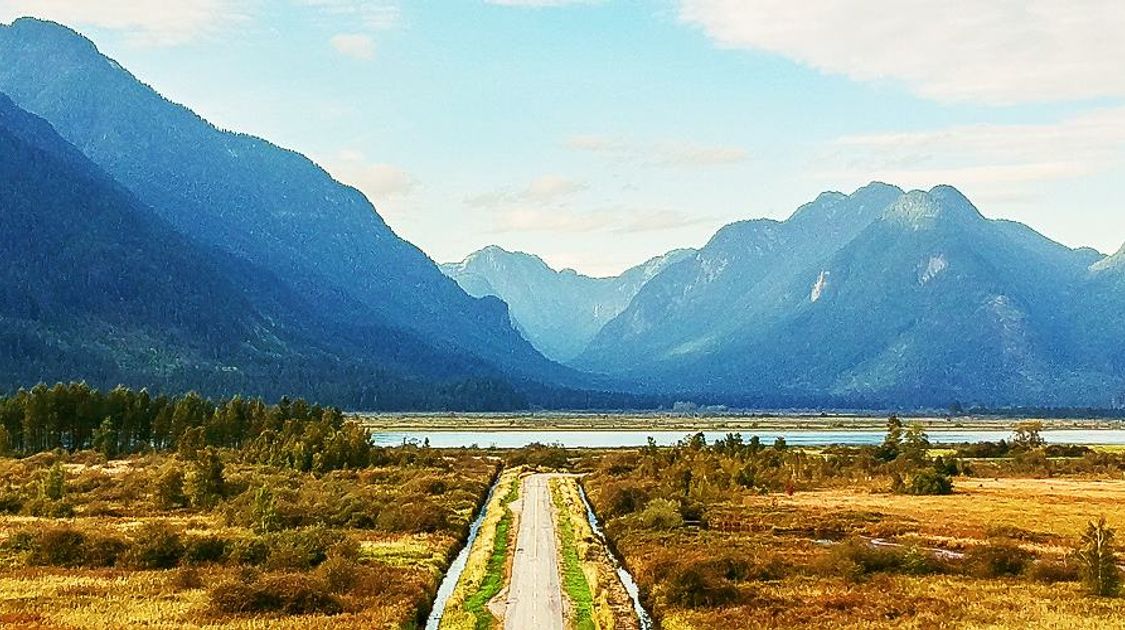
Choosing your family hike for the day can be a daunting decision. You know you need to pick a walking adventure that keeps tears and mumbles of boredom at bay. Happy kids make for a happier hike, right? But we recognize how tough it is to pick a trail tailor-made for everyone in the family.
Take a look at the 17 best family friendly hikes around Vancouver! The easy hikes below all have elevation gain, shorter durations, and entertaining scenery in mind. We hope you can find one, two, or three that suit your entire family. If all else fails, pack their favourite snacks to keep them happy! For families looking for a multi-day guided adventure, explore our Guided Family Tours.


What to Expect on Family Hikes near Vancouver in 2026
Planning a family hiking day near Vancouver for 2026? Here is what to know before you go:
- Best season: July to October offers the most reliable conditions; trails are dry, waterfalls are flowing and most facilities are open. Spring (April–June) can be muddy and some higher trails retain snow until July. Many lower-elevation trails (Whytecliff Park, Steelhead Falls, Capilano River) are accessible year-round on dry days.
- What to bring: Always pack a rain jacket regardless of the forecast; Pacific Northwest weather changes quickly. Bring layers, snacks, water, sunscreen and a swimsuit for waterfall trails in summer. A first aid kit and charged phone are essential. Bear bells or noise-making are recommended on longer wilderness trails like Widgeon Falls and Norvan Falls.
- Getting there: Most trails on this list require a car; transit options are limited. Parking lots fill quickly on summer weekends, especially July and August; aim to arrive before 9 am or after 3 pm. Some parks charge a day-use parking fee ($3–$10); bring cash or a credit card. Widgeon Falls requires a canoe or kayak to reach the trailhead.
- Wildlife: Black bears are present throughout the Vancouver region, particularly in parks east of the city (Golden Ears, Pinecone Burke). Make noise on the trail, keep children close, and never approach wildlife. Cougars are rarely seen but present. Check BC Parks advisories before visiting wilderness areas.
- Trail conditions: Check AllTrails or the BC Parks website for current conditions before heading out, especially in shoulder seasons. Trails at higher elevation (Dog Mountain, Crooked Falls) may be closed or icy October–June. All hikes on this list are free to access; some parks charge a parking fee.
1. Gold Creek Falls Hike

Gold Creek Falls Hike
Gold Creek Falls is the perfect hike for families (even those with strollers), those wanting a soothing (not crazy challenging) outdoor getaway, or for campers at Golden Ears Provincial Park. The scenic rainforest surrounding the trail forces you to get lost in the natural sounds and imagery playing before your eyes. You’ll undoubtedly fall in love with the ever-so mighty Gold Creek Falls! Oh, and bring your swimsuit. If you’re here during the summer, you’ll definitely want to splash around in the water.
Where? Golden Ears Provincial Park, East of Vancouver hiking trails
Length: 5.9 km
Time: 1.5-2 hours
Elevation: 105 m
Distance from Vancouver: 1.5 hours
Getting there: Go on Highway #1 (east) and take exit #44. Continue driving straight until you have to turn right for Lougheed Highway. Drive over the Pitt River Bridge and head towards Maple Ridge. Soon, you’ll reach an intersection for Lougheed Highway and Dewdney Trunk Road. Turn left and drive until you reach 232nd Street. Take a left here and after a kilometre, turn right (just after a small park). Continue along Fern Avenue until you arrive at the last parking lot.
Read the complete route guide for Gold Creek Falls.
2. Lost Lake Hike

Lost Lake Hike
Head to Whistler Village for this mesmerizing route! Meander through the ever-so stunning West Coast rainforest (or you can take the gravel path). After a short, pleasant stroll, you’ll reach the quaint Lost Lake. Enjoy a picnic at one of the tables set along the lake and a swim before you walk back.
Where? Whistler
Length: 5.1 km
Time: 1-2 hours
Elevation: 120 m
Distance from Vancouver: 1 hour and 45 minutes
Getting there: Go to Whistler Village and park in one of the public parking lots. Head to parking lot 5, and you’ll notice signs for Lost Lake. Start your hike here.
Read the entire Lost Lake Hike route guide.
3. Murrin Park Hike

Murrin Park Hike
Breathe in lovely views of Howe Sound without putting in too much effort! Murrin Provincial Park packs a punch for outdoor adventure: hiking, fishing, swimming, and rock climbing. You will reach rocks that require you to use a rope to climb on this hike, making this route more suitable for older children! The loop ends at Browning Lake, so bring your swimsuit along and enjoy a refreshing post-walk dip
Where? Murrin Provincial Park, Squamish
Length: 2.5 km
Time: 45 minutes-1 hour
Elevation: 120 m
Distance from Vancouver: 45 minutes
Getting there: Hop in your car and drive towards Squamish hiking trails along the Sea to Sky Highway. You’ll turn shortly after Britannia Beach. Notice signs for Murrin Provincial Park. Turn left into the parking lot. Browning Lake will be on your left as well!
Check out the route guide for Murrin Park Loop.
4. Jug Island Hike

Jug Island Hike
Bask in the fresh-scented air swirling around the cedar forest as you walk by two enticing bays: Belcarra and Bedwell. Their glimmering waters will beg you to jump in, so don’t forget your swimsuit! The Jug Island Hike is an excellent half-day activity.
Where? Belcarra Regional Park, East of Vancouver
Length: 5.3 km
Time: 1.5-2.5 hours
Elevation: 217 m
Distance from Vancouver: 1 hour
Getting there: Follow East Hastings Street from Downtown Vancouver to Highway 7A towards Port Moody. Take a left on Loco Road and continue until you turn right on 1st Ave. This road turns into Bedwell Bay Road. Continue driving along this road until you reach the parking lot that’s on your left.
Read the route guide for the Jug Island Hike.
5. Widgeon Falls Hike

Widgeon Falls Hike
The Widgeon Falls Hike is slightly different from the other walks mentioned on this list: it requires you to hop in a canoe or kayak and paddle to the trailhead. This added element elevates this family-friendly adventure from spellbinding to epic, don’t you think?
Where? Pinecone Burke Provincial Park, East of Vancouver
Length: 7.3 km
Time: 1.5-2.5 hours
Elevation: 198 m
Distance from Vancouver: 1 hour and 15 minutes
Getting there: Follow Highway 7 E (towards Pitt Meadows and Maple Ridge). Cross the bridge and take a left onto Dewdney Trunk Road. Take another left onto Harris Road before turning right onto McNeil Road. And then turn left onto Rannie Road and continue along until you reach the parking lot by the docks. It costs $5 to park here overnight, but it’s free to park here during the day.
Read the entire Widgeon Falls Hike route guide.
6. Norvan Falls Hike

Norvan Falls Hike
Long and steady wins the race! Well, that’s not the saying, but you probably get what I mean. The Norvan Falls hike may be 14.0km, but it’s relatively flat, making for an enjoyable nature outing. Let Lynn Creek guide you, and the forest shade refresh you as you meander towards Norvan Falls! Spend some time marvelling at the towering waterfall before heading back along the same route you came.
Where? Lynn Headwaters Regional Park (North Shore hiking trails)
Length: 14.0 km
Time: 4-6 hours
Elevation: 391 m
Distance from Vancouver: 40 minutes
Getting there: Head towards Fern Street if you’re departing from North Vancouver. This road eventually merges into Lillooet Road. Take a slight to stay on Lillooet Road. Continue driving until you reach the Norvan Falls parking lot.
Check out the route guide for Norvan Falls.
7. Whytecliff Park Hike

Whytecliff Park Hike
This hike may be super short, but it’s easy to turn a visit to Whytecliff Park into a full day of fun. You can spend the day meandering beaches, picking up seashells by the seashore (cue the tongue twister: “she sells seashells…” ), and exploring the natural wonders spanning this park. Check the tide schedule before you go! If it’s low, you may be able to walk across to Whyte Island.
Where? Whytecliff Park, North Shore
Length: 1.0 km
Time: 0.5-1 hour
Elevation: 38 m
Distance from Vancouver: 45 minutes
Getting there: Head towards Horseshoe Bay. As the ferry terminal’s turnoff emerges into view, take the exit for Eagleridge Drive (#2). When you reach the roundabout, take the 1st exit, which takes you to the Marine Drive ramp. Take a left onto Marine Drive, and take the 1st exit at the roundabout. At the next roundabout, continue straight along Marine Drive. Drive until you reach the Whytecliff Park parking lot.
Learn more details about this wonderful family-friendly hike in Whytecliff Park!
8. Sawblade Falls Hike

Sawblade Falls Hike
Let the varied scenery entertain your family like a storybook. Pass by some small waterfalls and stroll through a woodland wonderland before you reach the main attraction. It’s best to bring older children on this hike since it’s quite long and one of the more difficult ones on this list.
Where? Pinecone Burke Provincial Park, East of Vancouver
Length: 9.3 km
Time: 2-3.5 hours
Elevation: 333 m
Distance from Vancouver: 45 minutes
Getting there: Drive along the Lougheed Highway and when you reach Falcon Drive, go north. Take a right to turn onto Guildford Way. And then turn left on Pipeline Road. When you get to David Ave, go right. Shortly after, take a left on Coast Meridian Road. Turn right on Harper Road and continue along until you get to the end of the road and park your car along it.
Check out the route guide for Sawblade Falls Hike.
9. Steelhead Falls Hike

Steelhead Falls Hike
Not in the mood to do the Steelhead Falls Hike today, this month, or this season? Don’t worry. It’s not going anywhere. The low elevation makes it easy to do this hike year-round with your family - especially young families!
Where? Mission, East of Vancouver
Length: 1.9 km
Time: 0.5-1 hour
Elevation: 62 m
Distance from Vancouver: 1 hour and 20 minutes
Getting there: If you’re coming from Maple Ridge, take the Dewdney Trunk Road (east) until you reach Hayward Lake. You’ll find the parking lot to your right.
Read the complete route guide for Steelhead Falls Hike.
10. Squamish Smoke Bluffs Hike

Squamish Smoke Bluffs Hike
A hike and a playground in one? It sounds too good to be true, doesn’t it? It’s safe to say that the Squamish Smoke Bluffs Hike caters to both parents and young kids. You get the views, and your kids get a space to play. It’s a win-win! You’ll find an abundance of trails snaking through Squamish Smoke Bluffs Park, making it easy to create your own adventure. However, if you want to follow an official guide, we suggest checking out some route details below!
(Do note that there are stairs on this hike, so it’s not stroller-appropriate.)
Where? Squamish Smoke Bluffs Park
Length: 3.5 km
Time: 1-2 hours
Elevation: 223 m
Distance from Vancouver: 1 hour
Getting there: Go to Squamish. Downtown, at the main intersection, take a right onto Loggers Lane. Follow this road until you get to a crosswalk. You’ll see a sign for Smoke Bluffs Park here. Turn right into the parking lot.
Check out the route guide for the Squamish Smoke Bluffs Hike.
11. Crooked Falls Hike

Crooked Falls Hike
Disclaimer: this hike isn’t suitable for young kids, and may be best for families with teenagers! The elevation, and rocks and roots plaguing the trail can be hard on younger kids. But the falls at the end will grant you a memorable image of nature’s spectacularity.
Where? Squamish
Length: 6.0 km
Time: 3.5-4.5 hours
Elevation: 583 m
Distance from Vancouver: 1.5 hours
Getting there: Head to Highway 99. Drive towards Squamish, and take a left on Squamish Valley Road. Continue for 25.0 km. Soon the trailhead will come into view. The last few kilometres will have you driving along a gravel road.
Check out the Crooked Falls route guide.
12. Dog Mountain Hike

Dog Mountain Hike
Short, but friggin’ fantastic! At the top, hikers will get rewarded with a collage of views. Just think of the vistas of the Lower Mainland, Mount Baker, Stanley Park, Fraser Valley, and the Strait of Georgia as easy-earned trophies. This hike doesn’t disappoint, and you and your older children will appreciate the spectacular image of the valley sprawled below!
Where? Mount Seymour Provincial Park (North Shore)
Length: 4.9 km
Time: 1-2.5 hours
Elevation: 240 m
Distance from Vancouver: 50 minutes
Getting there: Head to Highway #1. Take the Mount Seymour exit. Continue along Mount Seymour Parkway. You’ll eventually see a sign for Mount Seymour Road. Take a left and continue. Park at the ski hill in the northern section of the top parking lot.
Read the Dog Mountain Hike route guide.
13. Crystal Falls Hike

Crystal Falls Hike
Many of the hikes on this list unveil waterfall views, and the Crystal Falls Hike is no different. This low-key meander winds through a canopy of thick forest and has you creek-hopping at various points. It’s a fun hike that leads to a stunning waterfall!
Where? Coquitlam, East of Vancouver
Length: 5.6 km
Time: 1-1.5 hours
Elevation: 123 m
Distance from Vancouver: 45 minutes
Getting there: Drive along either the Barnet Highway or the Lougheed Highway and once in Coquitlam, go north on Pinetree Way. Continue by Town Centre Park and Douglas College and take a right on David Ave. Continue driving for another few minutes. Take a left on Shaughnessy Street. At Karley Crescent, you’ll be able to find parking.
Check out the full route guide for the Crystal Falls Hike.
14. Capilano River Regional Park Hike

Capilano River Regional Park Hike
Let the glistening forest hues swallow you as you wind along one of Vancouver's oldest parks: Capilano River Regional Park. Within the trails covering 26.0 km of this park, you'll experience spellbinding natural wonders, such as the salmon hatchery, Capilano Canyon, the Cleveland Dam, and the Capilano River carving a path between lanes of sun-glistened trees. If you're looking for a specific family-friendly trail in this spectacular park, we've got just the route for you! Take a look at the specifics below:
Where? Capilano River Regional Park, North Shore
Length: 3.3 km
Time: 0.5-1.5 hours
Elevation: 157 m
Distance from Vancouver: 30 minutes
Getting there: Go to Highway #1 and take exit #14. Follow along Capilano Road—it eventually becomes Nancy Green Way - past the Capilano Suspension Bridge. You'll see clear signs for the Cleveland Dam; take a left into the parking lot here.
Read the route guide for Capilano River Regional Park Hike.
15. Brandywine Falls Hike

Brandywine Falls Hike
A natural masterpiece, the Brandy Falls Hike is a magical gem that cascades for 70 metres and is only a short distance from the parking lot. The views of the Brandywine Falls transport you to a mystical place that will have you forgetting about the world hundreds of metres away! The wide and flat trail leading to the falls is tailor-made for first-time hikers, too.
Where? Brandywine Falls Provincial Park, Whistler hiking trails
Length: 1.5 km
Time: 0.5-1 hour
Elevation: 35 m
Distance from Vancouver: 1 hour and 40 minutes
Getting there: Follow the Sea to Sky Highway from Whistler. You’ll eventually see a sign signalling a turnoff for Brandywine Falls. Take this. You’ll take a left into the parking lot! It can be busy, so try to leave early.
Check out the entire Brandywine Falls Hike route guide.
16. Nairn Falls Trail

Nairn Falls Trail
You may have to drive around 2 hours to reach the incredibly scenic Nairn Falls Trail, but everyone in your family will appreciate the short length while falling in love with the lush, picturesque scenery. After meandering a forested trail, you’ll reach the falls roaring through massive boulders.
Where? Nairn Falls Provincial Park, Pemberton hiking trails
Length: 2.6 km
Time: 1 hour
Elevation: 108 m
Distance from Vancouver: 2 hours
Getting there: Follow BC-99 N northeast for 29km before turning right onto Nairn Falls Park Road. The parking lot will be to your right.
Read the entire route guide for Nairn Falls Trail route guide.
17. Quarry Rock Hike from Deep Cove

Quarry Rock Hike from Deep Cove
The relaxing path winds to a view of the Indian Arm and Belcarra Mountains, where the whole family can revel in the breathtaking scenery before heading back the same way you came. Expect to encounter new wooden bridges en route to elevate accessibility! Your heart rate may also increase due to the 194 m elevation packed into a short distance, but the Quarry Rock Hike from Deep Cove never gets too challenging.
Where? Deep Cove, North Shore
Length: 3.7 km
Time: 1-2 hours
Elevation: 194 m
Distance from Vancouver: 30 minutes
Getting there: To get to the Quarry Rock Hike from Vancouver, follow Trans Canada Highway/BC-1 W. Go over the Ironworkers Memorial Bridge and take exit 22B. Follow the road for 5.5 km before turning left onto Deep Cove Road. Keep going for another 1.2 km. Eventually, the road will veer right and become Gallant Ave. 100 m later, take a left onto Panorama Drive. Find the parking lot on your right.
Check out the route guide for Quarry Rock Hike from Deep Cove route guide.
Which adventure will you try out first? Let us know! And, if you want to find more ideas for hiking, check out the 24 greatest hikes around Vancouver.
For a multi-day guided adventure beyond Vancouver, explore our Guided Vancouver Island Tours.
Articles about Trip Planning to the Canada's West Coast
If you have a big task on your hands to plan a trip to the West Coast of Canada, look no further! Check out the list below to find all the information that you might need.
Planning your West Coast Trip
- Planning your trip to Squamish
- Planning your trip to Strathcona Provincial Park
- Planning your trip to Victoria
- Planning your trip to Whistler
Vancouver and Sea to Sky Articles
Vancouver Island Articles
Richard Campbell
Jun 2, 2026
Richard is the Founder of 10Adventures, and as a writer shares his experience from 30+ years exploring the world by foot, bike, ski, and boat.
Recent stories
General
Travel Styles at 10Adventures: Find the Adventure That Fits You
10Adventures specializes in curated active holidays for travellers who want a trip shaped around their interests, ability, pace, and preferred dates.
Richard Campbell
Jul 26, 2026
Destinations
Japan Cycling Tours: Best Bike Routes and Trips for 2026
Japan cycling tours beautifully intertwine scenic landscapes with vibrant culture and signature dishes.
Nadine Gravis
Jul 25, 2026
Destinations
Europe’s Best Spring Walking Tours for the Over-50 Traveller
Spring is the season of renewal; wildflowers burst into color, coastal breezes soften, and historic villages wake after the quiet of winter.
Alex Todd
Jul 25, 2026