BlogDestinationsHiking in Italy: Explore Italy’s Most Breathtaking Trails on Foot in 2026
Hiking in Italy: Explore Italy’s Most Breathtaking Trails on Foot in 2026

Lynn Campbell
Mar 11, 2026
Lynn is the co-Founder of 10Adventures. She had never slept outside until she was 28 years old, and now is an ardent hiker, backpacker, traveller, and bike tourer!
Italy is a world-class hiking destination, and definitely deserves more buzz than it might get. We all hear the wonders of the Canadian Rockies, Patagonia, or Colorado, but Italy should be at the top of your hiking bucket list! Italy is shaped like a boot, after all. The basics are all here in Italy: sweeping vistas, high peaks, exciting flora and fauna. What Italy offers above and beyond your basic views is an incredible diversity of scenery. From volcanoes to Roman ruins to vineyards and castles, Italy is packed with views that’ll make you stop and pull out your camera. Of course, some pasta, bread, and wine at the end of a hike is just the cherry on top! Let’s get into Italy’s best hiking trails.
Many travellers searching for the best guided tours of Italy are really looking for well-planned itineraries with logistics handled. Our self-guided hiking and cycling adventures offer that structure while giving you the freedom to explore independently. Browse our handpicked Italy tours to discover unforgettable active journeys across mountains, coastlines, and historic villages.</p>
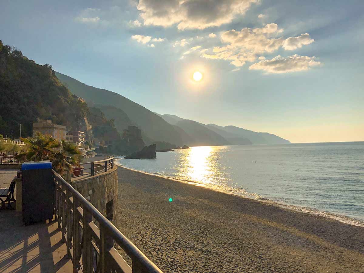
Beach of Monterosso al Mare on Cinque Terre hike in Liguria, Italy
Hiking in Cinque Terre
Cinque Terre is a UNESCO World Heritage site composed of five towns built into the dramatic coastline of Italy. The pastel buildings overlooking the ocean are an unforgettable view, and hiking through the area is our favourite way to appreciate the views.
There is a path system that links the villages. It’s not a strenuous or difficult hike, but it’s an unbeatable way to explore Cinque Terre. You’ll get to slowly experience the towns and the nature in between them without needing to get too sweaty!
Cinque Terre Details
Lots of hikers like to stay in the town of Riomaggiore when they arrive, then hike through each town along the way across the coast in order. The towns are certainly close enough together that you could book a room in any of them and still be able to easily complete your hike. Most travellers hike the Blue Path that links the towns. From Riomaggiore, you can reach Manarola on an easy 1.5km trail called “Lover’s Lane”, continue on to Corniglia on a relaxed 3km path, and then complete a 3.5km hike to Vernazza before you finish the entire path in Monterosso. Here is a Cinque Terre route guide.
It’s easiest to fly into Pisa, Florence, or Genoa. There are busses or trains from each airport center to Cinque Terre; it’s recommended that you take a bus or train as parking above the villages is somewhat limited.
The best time of year to hike in Cinque Terre is spring and early fall. Summer is a popular time for tourism, but the sweltering temperatures that can come in July and August might make hiking less comfortable.
Fun fact- there are no cars in Cinque Terre! The area really is a walker’s paradise. The area is actually a national park as well, despite the urbanization.

Cinque Terre Vernazza
Best Hiking Trails in Cinque Terre
The Blue Path
The Blue Path is the go-to path to hike between the towns of Cinque Terre. It’s fine to start from either end, but beginners may prefer to start in Riomaggiore. Over 12km you will gain 525m of elevation gain. Walking the Blue Path will take between 2.5 and 4 hours.
Riomaggiore Ring Trail
The Riomaggiore Ring Trail is stunning while being short enough for nearly anyone to take on. Feel free to walk it clockwise or counterclockwise. It's only 3.5km long, and takes about an hour to complete.
Cinque Terre Hiking Tours
The Cinque Terre Trek is a self-guided hiking tour of Cinque Terre is the perfect mix of adventure on foot and cultural immersion along the way.
Frequently Asked Questions About Cinque Terre
What are the five villages of Cinque Terre?
The five villages of Cinque Terre are Riomaggiore, Manarola, Corniglia, Vernazza, and Monterosso al Mare.
What makes Cinque Terre worth visiting?
Cinque Terre is often visited for its exceptional beauty. The colourful buildings perched atop the coast with an expansive ocean beyond is a must-see view. Visitors can also enjoy the famous perks of visiting Italy, including exceptional cuisine, wine, and culture. Hikers will love Cinque Terre for its trail system that connects each town, making seeing the entire area on foot a special experience.
Is Cinque Terre expensive to visit?
Cinque Terre isn’t the most budget-friendly place to visit, as there are somewhat limited accommodations in the area relative to demand and dining out is pricey. Travellers on a budget should book well in advance to secure the most affordable rooms and consider eating from groceries rather than restaurants. Small fees for Cinque Terre cards (which provide access to bus services, pathways, and other amenities) apply as well.

Cinque Terre stunning views of the peninsula
Hiking in Central Italy
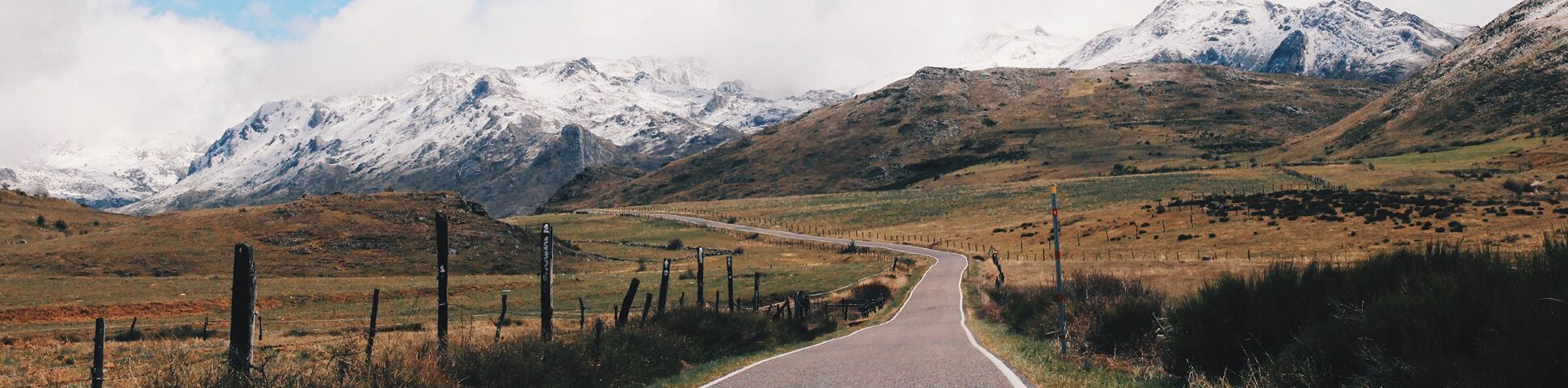
Central Italy has been one of the most special hiking destinations in the country for centuries. There are so many incredible self-guided walking tours in Central Italy. The ancient Via Francigena pilgrimage route attracts thousands of travellers every year, running from Canterbury in the UK (France being the mainland starting point) to Rome. Besides the pilgrimage route, there is fabulous hiking and walking in Tuscany, one of Central Italy’s most famous regions (check out our guide on planning a trip to Tuscany).
Embarking on a Via Francigena pilgrimage or touring through the countryside is a uniquely idyllic hiking journey that gives you the chance to enjoy world-class food, wine, and culture along the way. From the rolling hills and vineyards to the Lazio countryside, Central Italy proves you don’t need high peaks to have an incomparable hiking adventure!
Central Italy Details
Walking tours of the region surrounding Rome and the Via Francigena have nearly endless beginning and endpoints, but no matter where you start or how far you go, travelling the Via Francigena is without a doubt one of the most epic ways to hike in Central Italy. You’ll follow the footsteps of countless pilgrims before you, passing through picturesque landscapes and through unforgettable towns along the way.
To hike in Central Italy, you have a few options of where to begin your trip. Rome is one of the best cities to arrive in, and you can take a bus or train to plenty of unique towns from the airport. Some hikers prefer to fly into Rome, take transport to a small town to start their trek, and end off back in Rome so they can enjoy sightseeing after their trip. However you do it is up to you!
The best time to visit Central Italy to hike is April through October. Spring and fall are cooler and less busy, which some hikers prefer. July and August can be hot, which could make hiking a bit more uncomfortable.
Some of Italy’s finest wines come from the region, so if you have the chance to work a winery tour into your stroll, we’d recommend taking it!
Best Trails in Central Italy
Via Francigena
No, you definitely don’t have to hike the whole Via Francigena ! We do recommend taking on at least a portion of this legendary route through Central Italy.

Views on Via Francigena
Central Italy Self-Guided Hiking Tours
The beautiful section of the Via Francigena from Lucca to Siena is a classic walking tour in Central Italy. This beautiful self- guided tour treks through the heart of Tuscany, passing through historic towns like Siena and San Gimignano.
Another great section of the Via Francigena from Viterbo to Rome. This self-guided route immerses you in history, culture, nature, and fabulous cuisine as you walk the Via Francigena.
Frequently Asked Questions About Via Francigena
How long does it take to walk the Via Francigena?
The Via Francigena is no short stroll. The entire route covers over 2000km, which would take the average person about 100 days to complete. Not many of us have 100 days to spare, so most pilgrims will choose a much shorter section to enjoy.
Where does the Via Francigena start?
The Via Francigena starts in Canterbury, United Kingdom. However, those not wishing to cross the English Channel often begin their journey in northern France.
Can you cycle the Via Francigena?
Yes! Lots of travellers cycle sections of the Via Francigena. While the entire trail might not be nicely paved, it’s certainly passable by bike.
What does “Via Francigena” mean?
The moniker “Via Francigena” comes from “the road that comes from France.” The route was used in the Middle Ages before becoming more widely known as the route used by Sigeric the Serious, the Archbishop of Canterbury, to receive his pallium.

Historic towns on Via Francigena
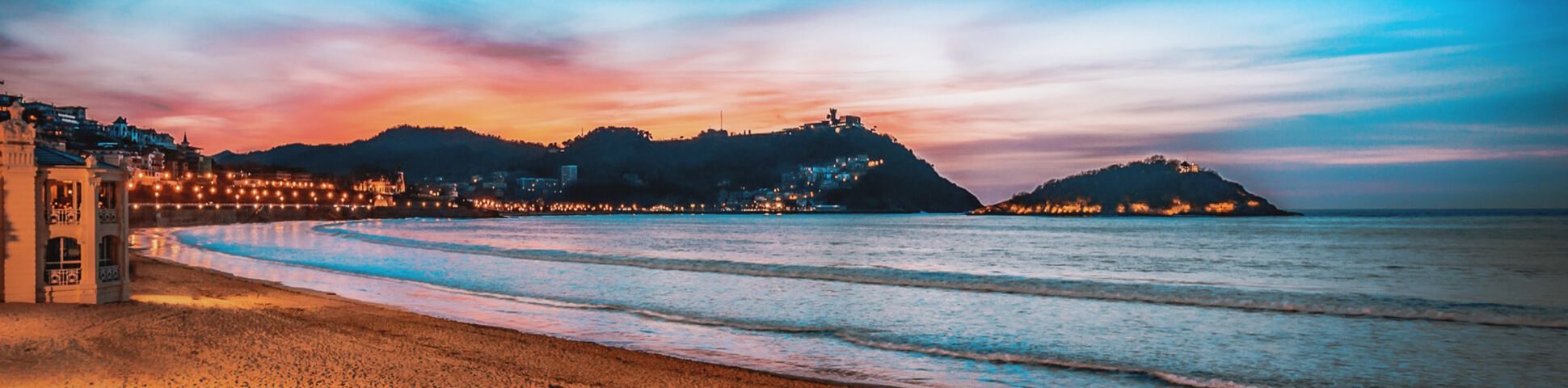
Hiking in the Italian Riviera
When you’re in the Italian Riviera, it can be hard to want to pull yourself away from the turquoise coves and pastel coastal towns, but it’s worth it to get some hikes in! This area is also known as Liguria, and it is nestled in between the south of France and Tuscany. From towering cliffs to unbelievably blue water, it’s paradise on earth and perfect for hikers.
We’ve already focused on Cinque Terre, so let’s talk about the unforgettable adventures on this larger stretch of the Mediterranean. The cities and towns are vibrantly beautiful, and the rugged cliffs above will treat you to magical views while you climb them.
Italian Riviera Details
The Italian Riviera has long been a destination for beachgoers, with picture-perfect coastline, wonderful weather, and inviting waters. Hikers get to enjoy the area from a unique vantage point, and then who doesn’t want to end their trek sipping a drink in Portofino? It’s the best of both worlds.
When planning your trip to the Italian Riviera, there are a few places you should consider staying. Historic Genoa is stunning, with UNESCO World Heritage sites and wonderful restaurants. Portofino is luxurious and flashy, with upscale accommodation. Portovenere is great during the busy season, with easy access to your adventures without the crowds of bigger centres. No matter which stunning town you make your home base, you’ll probably fly into Genoa, Milan, Pisa, or Nice if you’re staying in the far-west portion of the Riviera. While the Nice airport is technically in France, the border is a quick ride away.
The best time to head to the Italian Riviera to hike is from April through October. The summer months are the busiest, with more tourists and hotter weather. Because of this, a late spring or early fall visit might be your best bet.
Fun fact: Liguria boasts 340km of coastline, and there’s actually a point along the coast where a 2.5-metre tall statue of Jesus Christ is submerged.
Italian Riviera Hiking Tours
The Italian Riviera Self-Guided Trek is the perfect way to explore the Ligurian coast on foot, hiking from Genoa to Sestri Levante, passing through the stunning Portofino Regional Park.
The French and Italian Riviera Hiking is perfect if you can't choose between Liguria and Côte D'Azur? No need, this self-guided tour covers the best trails in both regions on a trek from Bordighera to the Roya Valley.
Frequently Asked Questions
Where should I hike in the Italian Riviera?
Where to start? Besides Cinque Terre, we love the Punta Manara trail, the Punta Chiappa trail from Camogli to San Rocco, and the Levanto to Monterosso Trail. If you want to feel like you’re leaving civilization behind a bit, the Sentiero Vernazza a Corniglia trail is all sheer green cliffs and wide blue sea.
What towns are in the Italian Riviera?
There are quite a few towns in the Italian Riviera, ranging in size from quaint to buzzing. A few more notable ones include Genoa, Portofino, Portovenere, Camogli, Vernazza, Riomaggiore, Sestri Leva, and Sanremo. The further along the coast you go, the more stunning towns you’ll find.
Why is it called the Italian Riviera?
“Riviera” is an Italian word meaning “coastline.” Since the Italian Riviera is arguably the most notable section of coastline in the country, it’s only natural that it claimed the title.
What’s the best city in the Italian Riviera?
The best city or town in the Riviera will depend on who you ask! Each town is beautiful and each offers a different slice of coastal lifestyle. Depending on your preferences when it comes to size, accommodation, number of tourists, and selection of hotels and restaurants, your go-to spot on the Riviera could be completely different from ours.

Stunning beaches in the Italian Riviera
Hiking in the Dolomites
If you’re a hiker that craves elevation, a Dolomites self-guided tour is where you need to be. This portion of the Southern Limestone Alps makes up the most impressive mountain scenery in Italy, and they’re a favourite among summit seekers from all over the world. Sprawling green valleys, sheer limestone walls, and the signature pale mountains of this region are unlike any other.
One of the most unique aspects of hiking in the Dolomites is the rifugios, which are mountain huts scattered throughout the range. Hut-to-hut hiking is exactly what it sounds like: You can trek from one hut to the next, never having to leave the mountains as you adventure through. This makes multi-day treks especially fantastic and accessible in the Dolomites. Check out our guide on planning a trip to the Italian Dolomites.
Dolomites Details
The Italian Dolomites lie in the northeastern part of Italy, spanning 7 provinces and bordering Austria to the north. The mountains have been a UNESCO World Heritage Site since 2009, and there are several regional parks within the range. While they take their name from the carbonite rock dolomite, they’re also known as the “Pale Mountains” because of their lightened appearance.
When it comes to planning your trip to the Dolomites, it’s easiest to fly into Venice and take public transportation to the mountains. There are several direct busses, or you could always rent a car if you prefer to drive yourself. You’ve got plenty of options when it comes to villages and towns to stay in at night, so we’d recommend deciding which portion of the range you’d like to explore and choosing accommodations in one of the nearby towns. If you’re completely unsure, we like Cortina d’Ampezzo. There are plenty of hotels ranging from rustic to luxurious if you’re not looking to stay in a rifugio.
The best time of year to go hiking in the Dolomites is the summer, since temperatures tend to hover around a comfortable 20-25 degrees Celsius (68-77 degrees Fahrenheit). It is the busiest season for tourism, so those seeking a quieter time might prefer late spring or early fall, when most routes are still passable.
Best Trails in the Dolomites
Tre Cime di Lavaredo
One of the most enjoyable hikes in the Dolomites, the Tre Cime hike is one of the best-known massifs in the area. The three towers make for an iconic view. This 10.2km hike has 380m of elevation gain and takes 3 to 5 hours to complete.
Lago Sorapis
The Lago Sorapis hike is stunning, and the beautiful hike covers all the wonderful scenery you’d expect in the Dolomites, but with a treat: the baby-blue Lago Sorapiss. Those with a fear of heights may not appreciate this hike, but bold adventurers will love it. You'll walk 13.5km and gain 325m of elevation gain. Expect to spend 4 to 5 hours on this walk.
Lago di Carezza
The Lago di Carezza hike is another classic Dolomites hike. Carezza lake and the surrounding forest and mountains are magical. Not too much effort is required to enjoy a major reward when it comes to Lago di Carezza. This 3.5km trail gains 280m of elevation and takes between 1 and 2 hours.
There are plenty more incredible trails in the Dolomites, so this is just a start!

Mountain peaks in the Italian Dolomites
Dolomites Hiking Tours
The Dolomites Self-Guided Hiking tour allows you to explore some of the best hikes in the Dolomites at your own pace over one week.
Like the sound of a self-guided hiking tour of the Dolomites but don’t quite have a week to spare? The 5-day Self-Guided Hiking in the Dolomites Tour is the perfect chance to experience the best hiking in the region on a shorter trip.
Exploring the Dolomites from mountain huts is spectacular!This Dolomites Hut to Hut Hiking Tour goes from Tre Cime to Lago di Braies and gets you high into the Dolomites for 6 unforgettable days.
Discover the incredible valleys, karsts, forests, and mountains of the Fanes-Sennes Nature Reserve on this self-guided Dolomites Walking Tour in Alto Adige.
Frequently Asked Questions
Where in Italy are the Dolomites?
The Dolomites are located in northeastern Italy, near the border with Austria.
Are the Dolomites worth visiting?
Absolutely! We consider the Dolomites to be an absolute bucket-list destination for adventure travelers. Anyone who loves mountains and hiking should consider visiting.
Do you need a car in the Dolomites?
Having a car in the Dolomites could make your trip easier. Getting from place to place without having to account for public transport availability gives you more time to hike, but make sure you’re comfortable with winding mountain roads and unfamiliar traffic signals. There are busses that service towns in the Dolomites, so if you cannot rent a car you can still get from A to B.
Is hut-to-hut hiking considered to be hiking or trekking?
Check out our hiking vs trekking guide to learn more.

Breathtaking landscape of the Italian Dolomites
Hiking in Gran Paradiso National Park
Gran Paradiso National Park is sometimes considered Italy’s Yellowstone. It’s nestled between Piedmont and the Aosta Valley, and claims the title of Italy’s oldest national park. First declared in 1922 as a protected area for endangered ibex, it now offers over 71,000 hectares of spectacular mountains, glaciers, lakes, and valleys.
The park is astonishingly biodiverse, with 168 species of flora, 1,124 species of fauna, and only 0.2% urban development by area. To keep with the numbers, there are 553km of trails just waiting for you to explore, divided by five different valleys.
Gran Paradiso Details
Gran Paradiso is a hiker’s paradise and a must-visit for any adventure traveller in Italy. Anchored by the mountain of the same name, the park spans over northwestern Italy and provides seemingly endless places to explore.
If you’re visiting Gran Paradiso, it’s easiest to fly into Turin and make the hour-ish drive. Milan is also an option, but the drive is closer to 3 hours. Renting a car provides the most ease of travel within the park, but there are also busses and trains if you can’t get your own wheels. Lots of visitors to the park stay in Cogne, but you can also use villages on the other side of the park as your home base depending on where you’re wanting to hike. The park’s website has a list of all accommodations in the park that meet their quality standards.
The best time of year to visit Gran Paradiso is the summer, as the warmer weather ensures all trails are passable and dry. If you’re wanting to avoid the tourist rush, you could visit in the late spring or early fall, noting that some higher-elevation hikes might be wetter depending on the weather.

Beautiful valleys in Gran Paradiso
Best Trails in Gran Paradiso
Sella-Herbetet Traverse
This trek heads from Rifugio Sella to Casolari dell’Herbetet through the stunning Gran Paradiso range. You’ll enjoy sweeping views of the mountains and probably spot some ibex along the way. You'll walk 20km and gain 1,125m of elevation gain. Expect to walk 7 to 8.5 hours on this tough day.
Alpe Money
The Alpe Money hike won’t make you rich, you’ll be treated to beautiful views of Gran Paradiso and the fabulous Money and Tibolazione glaciers. This trail is 16.3km long, and gains 1,135m of elevation. Expect to walk 7 to 8.5 hours.
Colle della Rossa
If you’re ready and willing to really test the endurance of your legs, the Colle della Rossa hike is majorly rewarding. Over 18.2km, and 1,764m of elevation gain you’ll end up in the Alpe Lauson high valley with spectacular views. This is an exhausting 7 to 10 hours walk!
There are plenty more fantastic hikes in Gran Paradiso to choose from! Or choose a self-guided Gran Paradiso walking tour.
Frequently Asked Questions
What makes Gran Paradiso worth visiting?
Besides its unique history as Italy’s first national park, Gran Paradiso is worth visiting because of the stellar scenery and exciting recreational opportunities it provides! Winter or summer, the thrill of the mountains is always worth seeing.
Is hiking in the area dangerous?
Hiking anywhere carries some inherent risk. You’ll want to keep the same safety precautions in mind in Gran Paradiso that you would anywhere else- hike with a buddy, plan your route ahead, come prepared with the right equipment, and don’t try anything you’re not experienced enough for.
Can you climb Gran Paradiso?
Yes, all 4061m of Gran Paradiso are climbable! Of course, this requires mountaineering skills and isn’t a suitable objective for most hikers.

Gran Paradiso Valnontey Valley
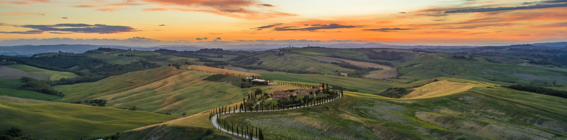
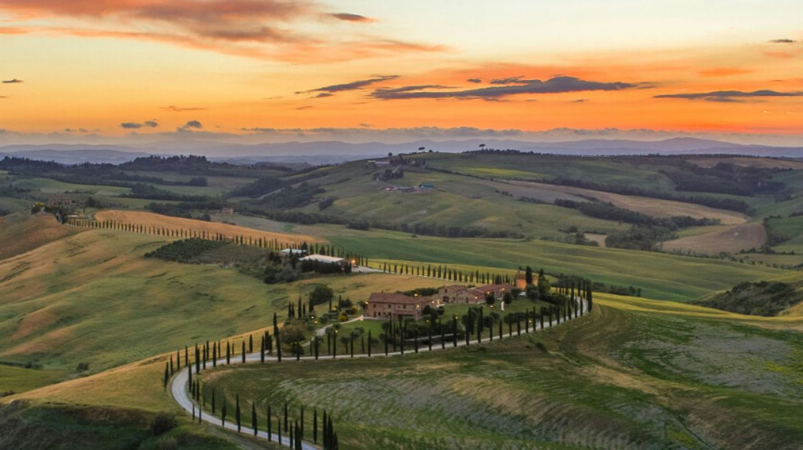
Hiking in Tuscany
Ah, Tuscany. Rolling hills, vineyards, charming villas, and golden sun. While this part of Italy might not boast as many high mountains as the Dolomites or Gran Paradiso, it’s a region best explored on foot. Walking and trekking tours in Tuscany are popular not just for their beauty, but also for their accessibility. Not having to climb several thousand feet on any of Tuscany’s hikes makes it easier for more people to enjoy exploring the area. However, those with a taste for elevation will find some great hikes in Tuscany’s Apennine Mountains that suit their style.
Of course, one of the main draws when it comes to Tuscany is the food and wine. We’d happily end every trek with focaccia and a glass of chianti, and we wouldn’t blame you if you planned one of your hikes to pass by a winery!
Tuscany Details
Tuscany is located in north-central Italy, with the Apennine Mountains in the north, the Tyrrhenian Sea to the west, and miles of rolling hills in the centre. From Florence to the Island of Elba, Tuscany is diverse in its landscape and cities and stunning the whole way through.
When visiting Tuscany, most people will fly into Florence, which is the capital city and largest in the region. Florence is also closest to the largest mountains in Tuscany, which run down the middle of the country. From Florence, you have easy access by bus, train, or rental car to essentially every point of interest in Tuscany. Those looking for hills and vineyards might enjoy spending some time in San Gimignano or Siena, and those wanting a more challenging hiking experience should head towards towns like Badia Tedalsa, Marradi, or Palazzuollo sul Senio that are nearer to the mountains.
The best time of year to hike in Tuscany depends on which area you’d like to visit. Those heading towards the Apennines might prefer to go in the summer, as the mountains don’t get quite as scorching as the rest of Tuscany can. Those trekking closer to Florence or the coast might find spring and early fall more comfortable, as temperatures in the summer are very hot.

Stunning Tuscany beaches
Best Trails in Tuscany
Lago Scaffaiolo and Corno Alle Scale
This Lago Scaffaiolo hike is great if you’re hungry for Tuscanys mountain scenery. The hills are ever-undulating and the views are blissful. This hike is 13.km and gains almost 700m of elevation. Expect to spend 4 to 5 hours on this hike.
Pienza to Montepulciano
For classic Tuscan countryside, the walk from Pienza to Montepulciano doesn’t disappoint. You’ll pass olive groves and pretty villas, mostly keeping off the main road. You'll walk 15.9km and gain 625m of elevation. Expect to walk 5 to 6 hours.
Monte Croce
While the scenery might not scream “Tuscany”, the Monte Croce hike is a must-do! You’ll get expansive views over green-clad mountains without too many other people crowding the trail. You'll gain 550m of elevation on this 7.5km hike. Expect to walk from 3.5 to 4.5hrs.
Of course, there are plenty more great hikes in Tuscany beyond these. Or choose a self-guided Tuscan Walking holiday.
Frequently Asked Questions
Is Tuscany expensive to visit?
Unfortunately, Tuscany is one of the more expensive parts of Italy to visit, as both hotel and food costs tend to run a bit high. Those wanting to save some euros can book in hostels, eat from grocery stores, and arrange their trip well in advance to secure good pricing in high-demand areas.
What is the most beautiful part of Tuscany?
How could you ask us to choose?! Tuscany is renowned for its beauty. Between mountains, soft golden hills, vibrant cities, and blue coastline, each area has something special to offer. We do recommend spending some time in the central countryside to appreciate the quintessential Tuscan scenery.

Florence Tuscany
Hiking on the Amalfi Coast
This Mediterranean jewel is an unforgettable hiking destination. Shimmering turquoise seas, sheer cliffs, and colourful towns make every turn on the Amalfi Coast sublime. We might even venture to say that this region offers the best hiking south of the Dolomites.
The Amalfi Coast runs along the Sorrentine Peninsula, anchored by the lovely city of Positano. From hidden coves to lush forest, the landscape is one of contrasts. Hot weather and inviting water make it a beach bum’s paradise along the shore, but the rocky cliffs just above the water’s edge hold legendary hiking trails.
Amalfi Coast Details
A legendary holiday destination, the Amalfi Coast stretches 50km along the Salerno Gulf. Long a favourite of the rich and famous, the coastline boasts sumptuous villas, fine restaurants, and flashy hotels. However, this lovely spot is a perfect holiday destination for many, including hikers! Planning a trip to the Amalfi Coast should be on everyone’s bucket list.
The closest international airports to the Amalfi Coast are Naples and Rome. Both offer direct transport to Amalfi, Positano, and Ravello, which are the most popular places to stay on the coast. You can rent a car in Naples or Rome to take to the coast, but make sure to check whether your hotel offers free shuttle service before you book. Speaking of booking, do so well in advance, and keep in mind that some hotels only operate from May to October.
The best time of year to visit the Amalfi Coast is from May through October, but most people favour the hot summer months. Some accommodations are seasonal, so we wouldn’t recommend trying to visit in the off-season or you may have trouble seeing and doing everything you want to. Hikers might enjoy spring and fall for slightly cooler weather.

Amalfi Coast mountains
Best Trails on the Amalfi Coast
Path of the Gods
Hiking the Path of the Gods is undoubtedly the most famous hiking trail on the Amalfi Coast. The views across the sea are expansive and you’ll have a birds-eye look at the colourful towns and cliffsides. This trail is 5.2km long, and gains 320m over 2 to 3 hours of walking.
Punta Campanella
The Punta Campanella hike makes you feel like you’re stepping back in history. You’ll pass old temples and buildings where Greeks and Romans worshipped. Also, the views of Capri are wonderful! This 7.1km hike gains 600m of elevation and takes 2.5 to 4 hours.
Bay of Ieranto
For an easier jaunt with just-as-rewarding views, the Bay of Ieranto walk is a great pick. You’ll have great views of Capri and the wave-carved rocks in the bay. At only 4.7km, this trail climbs 325m of elevation and takes 1.5 to 3hours to complete.
Check out plenty more fabulous hikes on the Amalfi Coast! Or explore the variety of self-guided Amalfi Coast walking holidays.
Amalfi Coast Hiking Tours
You can cover the Amalfi Coast and Capri Walking Tour on foot on this magical 7 day walking tour, which gets you up close with Mount Vesuvius and onto the Path of the Gods.

Atrani Sea Amalfi Coast
Frequently Asked Questions
Is the Amalfi Coast expensive to visit?
This region is favoured by wealthy travellers, so don’t be surprised to find that hotels and dining are more expensive than many other parts of Italy. Make sure to book well in advance to secure a spot at more affordable prices, as demand in the high season can drive up the cost of a hotel room or a car rental significantly.
Why is the Amalfi Coast so famous?
The beauty of the area has made it a favourite of celebrities and high-profile visitors from around the globe. The reputation it has is well-deserved in our opinion- it’s a lovely place to be.
What cities are on the Amalfi Coast?
The main cities and towns along the coast are Amalfi, Positano, and Ravello. There are other smaller towns that get less tourist traffic as well.
Do you need a car on the Amalfi Coast?
Having your own car to drive always makes getting around easier, but those who don’t wish to rent a car should find sufficient options for public transport to and around the area.
Can you swim on the Amalfi Coast?
Yes! There are plenty of popular beaches with swimmable water on the Amalfi Coast. Otherwise, we think sitting on the beach and being tempted by the water would be a bit torturous.
For even more amazing adventures in this beautiful country, check out some of the best tours in Italy.
If you’re looking to turn these iconic trails into a seamless adventure, explore our italy guided tours for expertly planned itineraries across the Dolomites, Tuscany, Cinque Terre, and the Amalfi Coast. Whether you prefer self-guided walking holidays or fully supported trekking experiences, you’ll find options that combine unforgettable hiking with authentic Italian culture.
Lynn Campbell
Mar 11, 2026
Lynn is the co-Founder of 10Adventures. She had never slept outside until she was 28 years old, and now is an ardent hiker, backpacker, traveller, and bike tourer!
Recent stories
Destinations
Italy Cycling Tours: Best Regions, Routes and Trips for 2026
Experience Italy beyond the more famous attractions and cities on a cycling tour.
Nadine Gravis
Jun 9, 2026
Destinations
Camino Francés 2026: A Pilgrim’s Guide to the Route, Stages & 2027 Holy Year
Of all the Camino de Santiago route possibilities, the self-guided Camino Francés tour, otherwise known as the French Way, is by far the most popular.
Claire Whitters
Jun 8, 2026
Destinations
Camino del Norte 2026: Itinerary, Accommodations, History and the 2027 Holy Year
The self-guided Camino del Norte is an adventure of a lifetime, and 2026 is the year to walk this incredible Camino route.
Claire Whitters
Jun 8, 2026