Best Hikes in Crans-Montana, Switzerland in 2026
Activities in Crans-Montana
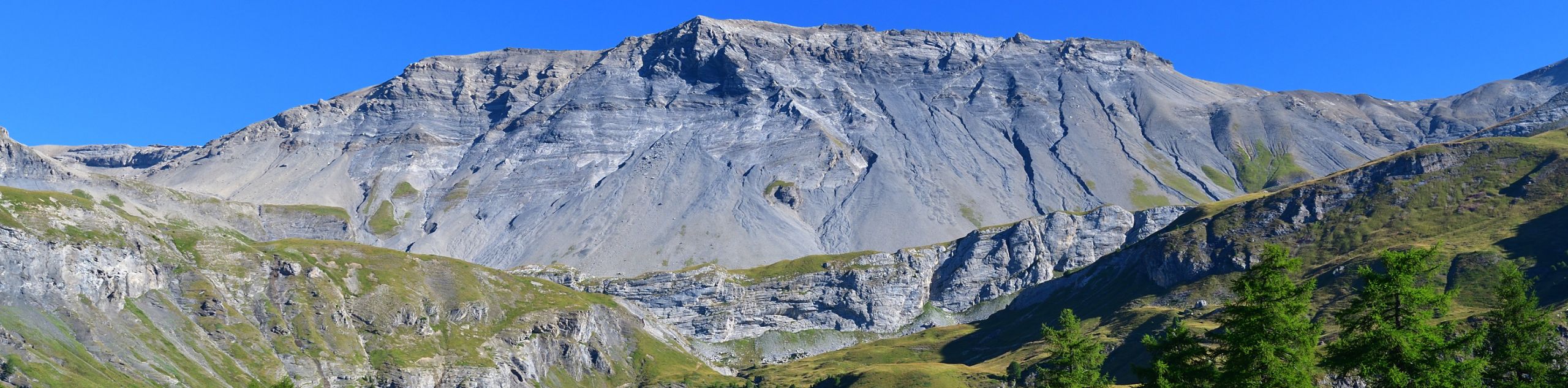
For adventurers who want to experience the breathtaking beauty of the Swiss Alps during any month of the year, Crans Montana is the ultimate outdoor destination. Located in the canton of Valais, Crans Montana is home to beautiful alpine hiking routes that can be enjoyed in the summer and world class ski slopes for the winter months, making the region an ideal adventure travel destination year-round.
Serene alpine valleys, charming lakes, sprawling vineyards, a luxury resort, and of course the dramatic mountain landscape of the Alps all make Crans Montana the perfect getaway for anyone who enjoys spending time outdoors. So what are you waiting for?! Pack your bags and get ready to explore the natural beauty that Switzerland and the Crans Montana region have to offer!
If you want the logistics handled before or after your time in Valais, browse our self-guided and guided Switzerland hiking tours, which include organized hiking trips across the Swiss Alps.
What’s New in Crans-Montana in 2026
Crans-Montana remains one of Valais’s most flexible mountain bases, with lower bisse walks, lakeside routes and high alpine trails all close to the resort. For 2026, plan high routes such as Cabane des Violettes around the main summer hiking window, generally June to October, and keep more sheltered bisse routes in mind for shoulder-season days. Many walks use lifts, buses or hut services, so check operating dates before committing to longer routes. Weather can change quickly above the Rhône Valley, so pack a light rain layer and build in flexibility for stormy afternoons.
Best Hikes in Crans-Montana by Type
Looking for the right Crans-Montana hike for your day? Start with these route types, from easy family walks around the resort to classic bisse trails and longer alpine days.
Best Family-Friendly Hikes in Crans-Montana
- Crans Montana Family Walk: a very easy 1.9 km resort walk with playgrounds, ponds and stroller-friendly sections, perfect for young children.
- Squirrel Path Hike: a short forest route from Place d’Ycoor where kids can enjoy an easy walk and spot the squirrels that give the trail its name.
Best Half-Day Hikes in Crans-Montana
- Bisse du Ro hike: the standout GSC route cluster, following a historic water channel toward the Rawyl Dam with big views and a few exposed sections.
- Bisse du Ro Short Hike: a shorter loop that gives hikers a taste of the famous bisse without committing to the full one-way route.
- Bisse de Clavau hike: a scenic water-channel route through the Rhône Valley vineyards, matching one of the strongest query clusters.
- Grand Bisse de Lens Short Hike: a shorter bisse walk linking Icogne and Lens, with views over the Rhône Valley and the Christ-Roi statue.
Best Full-Day Hikes in Crans-Montana
- Cabane des Violettes hike: a demanding 19.6 km alpine route with more than 1,100 m of climbing, best for fit hikers who want big mountain views or a hut overnight.
- Walk Around Lake Tseuzier: an easy but memorable reservoir walk near the Rawyl Dam, useful for the “Crans Montana hike to dam” search intent.
- Huiton Trail: a high alpine route toward the Plaine-Morte Glacier and Cabane des Violettes, with strong views over the Valais Alps.
Hiking Near Crans-Montana
Crans-Montana sits in the Valais Alps, so it pairs naturally with other Swiss mountain regions. For more high alpine routes, browse our Swiss Alps hikes, or compare this region with the full collection of hikes in Switzerland. For a wider search, explore all our hiking destinations.
Switzerland Hiking Tours
If you want a longer alpine walking holiday with the details arranged, start with our self-guided and guided Switzerland hiking tours. Since Crans-Montana is close to classic cross-border Alpine routes, you can also look at a guided Tour du Mont Blanc or browse broader self-guided walking tours in Europe.
Other Outdoor Activities in Crans-Montana
Crans-Montana is also a year-round resort, with winter skiing, road cycling, mountain biking and vineyard walks all close by. If you would rather explore Switzerland on two wheels, browse our self-guided Switzerland bike tours for regional cycling holidays with luggage transfers and route planning handled.
Displaying 21 of 21 routes
Route guides for Hiking in Crans-Montana
0 hours
144 hours
0
5
0
10
Bisse du Ro Hike Route Guide
Cabane des Violettes Hike Route Guide
Bisse de Clavau Hike Route Guide
Bisse du Tsittoret Hike Route Guide
Squirrel Path Hike Route Guide
Huiton Trail Route Guide
Marmot Path Route Guide
Bisse du Tsittoret Extended Hike Route Guide
Lakes Walk Route Guide
Extended Lakes Walk Route Guide
Cry d’Er, Pépinet, and Mt Lachaux Hike Route Guide
Walk Around Lake Tseuzier Route Guide
Behind the Waterfall Hike Route Guide
Statue du Christ-Roi Hike Route Guide
Panorama 4000 Hike Route Guide
Grand Bisse de Lens Short Hike Route Guide
Col du Pochet Hike Route Guide
Le Trubelstock Hike Route Guide
Crans Montana Family Walk Route Guide
Bisse du Ro Short Hike Route Guide
The Wine Walk Route Guide
1-21 of 21 routes
WE ARE HERE TO HELP
Let someone else do the hard work, book a custom tour in over 85 countries.
Chat with us on our contact page or fill out the form below!